Day 2 – Eriskay to Howmore Chapel
Images of the day (Google photos)
Phew, that was a long day. Almost 8 hours on the trail and 34 km walked, I haven’t done that much in a while. But I made it, and now I’m sitting in the bar of the Borrodale Hotel, enjoying a single malt while typing up the journal. It’s a 10-year-old Ledaig, which I hadn’t tried before. Very peaty, which means it’s not for Mert.
Partly because of this whisky, the report will probably be a bit shorter, as I’m super tired. But at least I don’t have to get up as early tomorrow. Today, I had to catch a ferry…
For the fourth and unfortunately last time, Dan drives me around Barra. He picks me up at 8:30 so I can comfortably catch the 9:25 ferry to Eriskay. This time, we take the west side of the island, and when we arrive at the ferry terminal, I feel like I’ve covered every paved road on Barra. I bid a warm farewell to Dan because it was really nice traveling with him – we had great conversations every time.
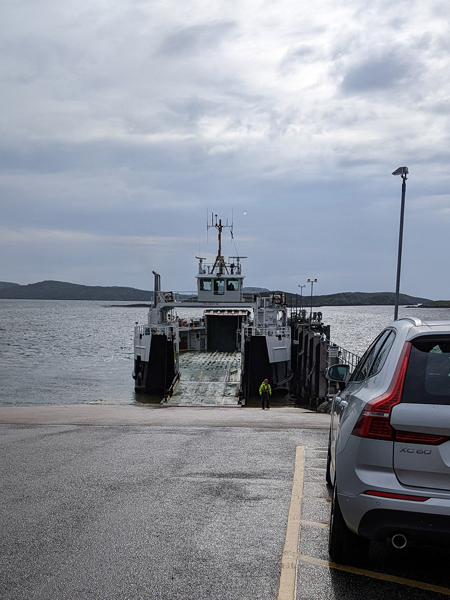
The ferry is already at the dock, a small open vessel, similar to the one I used during my Inner Hebrides tour to Arran. It was stormy back then, but it won’t be as bad today since there are just a few raindrops threatening to fall. During the crossing, I see some seals on the rocks, but still no dolphins or whales. The ferry takes 40 minutes to reach the small island of Eriskay, where a taxi is waiting to take my luggage to Borrodale. The driver – whose name I don’t yet know – is momentarily confused, as he expects to take me to the hotel as well. No, thank you, I’ll walk! Just please pick me up at 6 p.m. tonight at the Howmore Chapel. Alright, let’s go.
It’s raining a bit, and I’ve already put on both my wind and rain jackets, a layered approach. I had hoped to shed one of the layers at some point during the day, but that hope won’t be fulfilled. There are frequent rain showers that make me appreciate the direction of my hike: on the Hebrides, the summer winds usually blow from the south, so at least I don’t have the rain in my face.
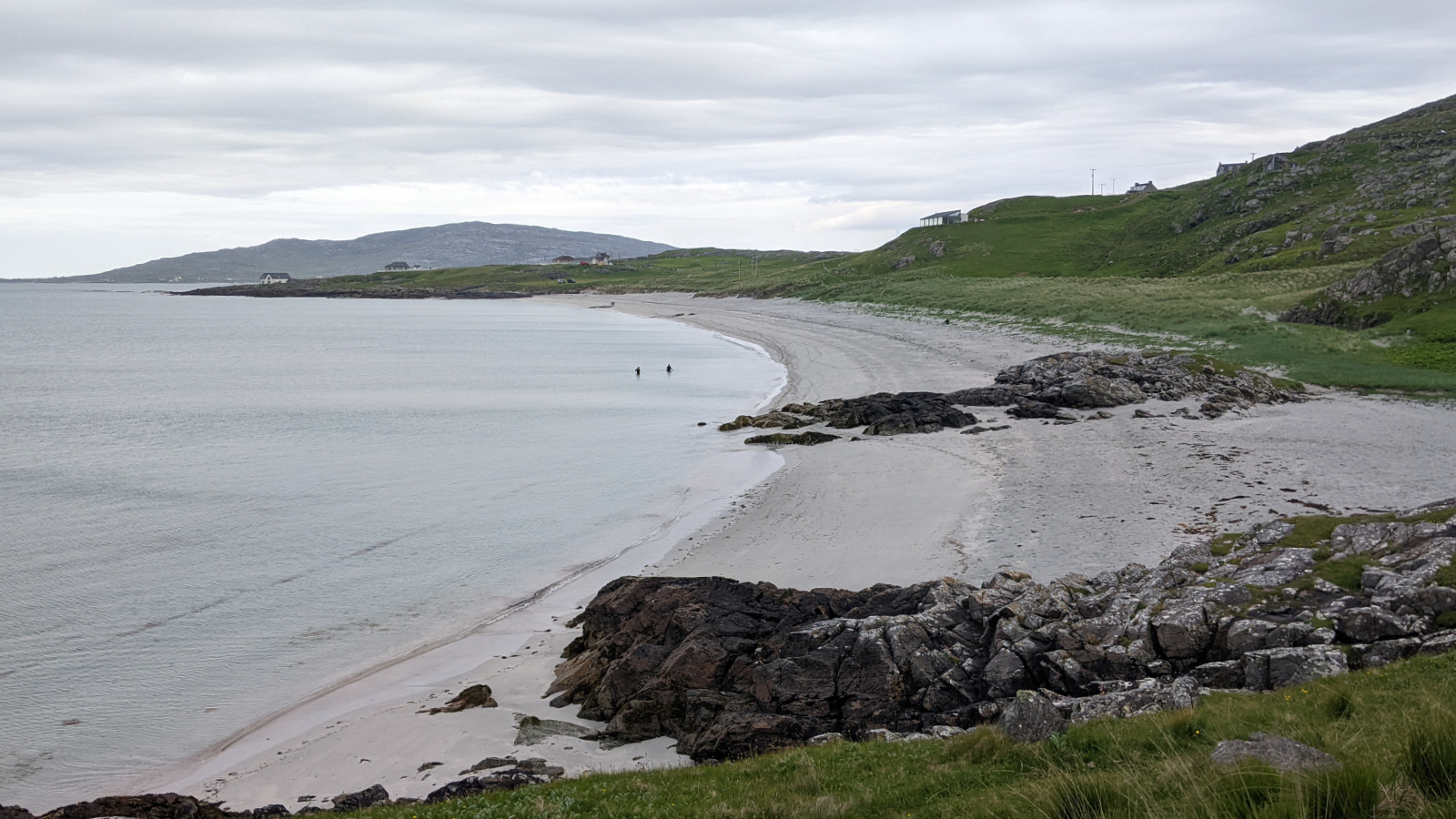
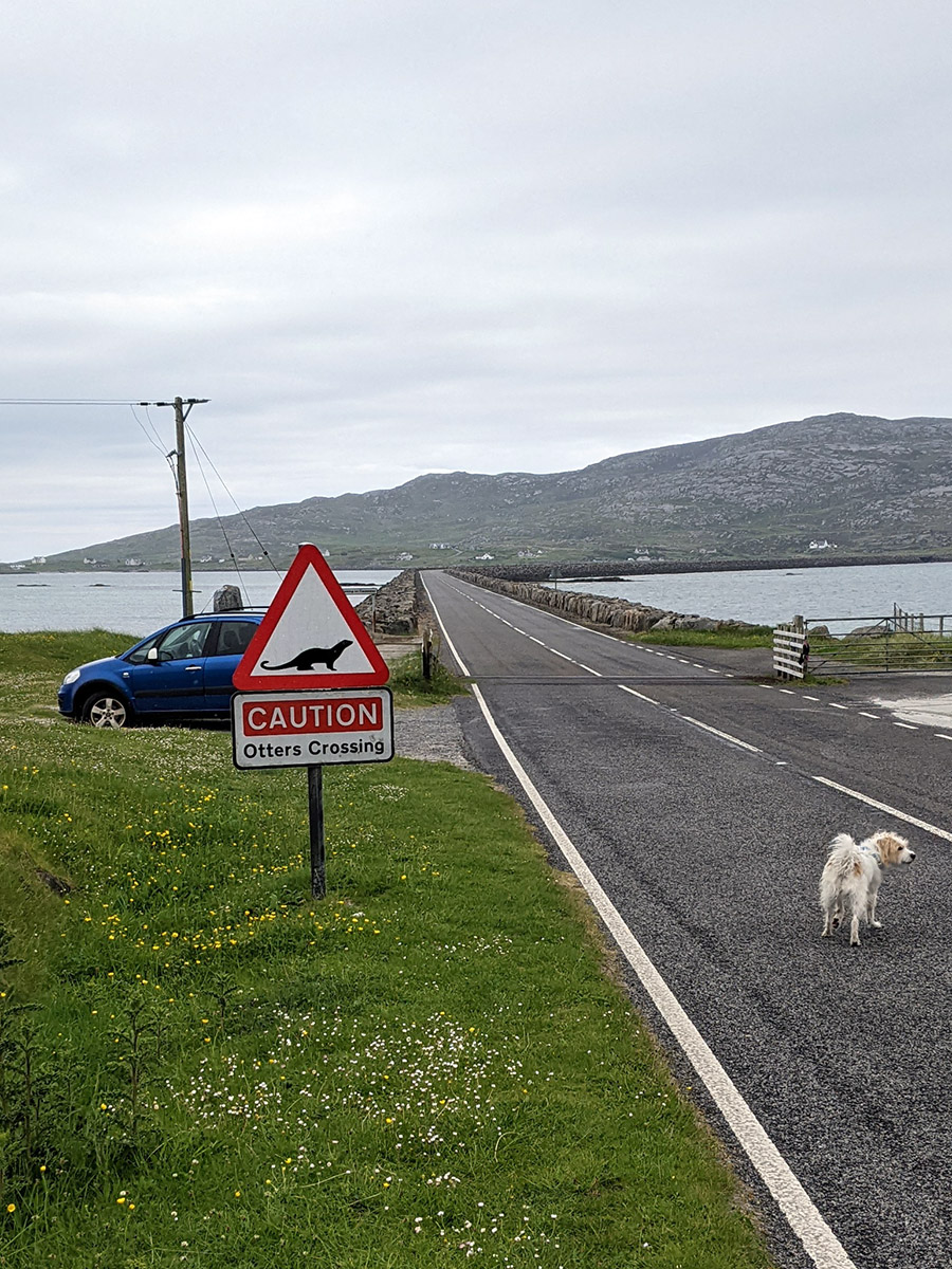
I walk across the white “Prince’s Beach,” where almost 267 years ago, Charles Edward Stuart, better known as “Bonnie Prince Charlie,” landed from French exile to claim the Scottish throne. It didn’t go so well, and he had to flee the Hebrides, allegedly dressed as a maid in women’s clothing. I don’t encounter any Scottish princes (although the Stuart family still exists), but a little white dog joins me, accompanying me for quite a while until we reach the causeway to South Uist. The 1.5-kilometer causeway scares him off, and he stays behind at the beginning. It’s not the most pleasant route for me either because the rain is getting stronger, and I can’t expect any shelter from the wind.
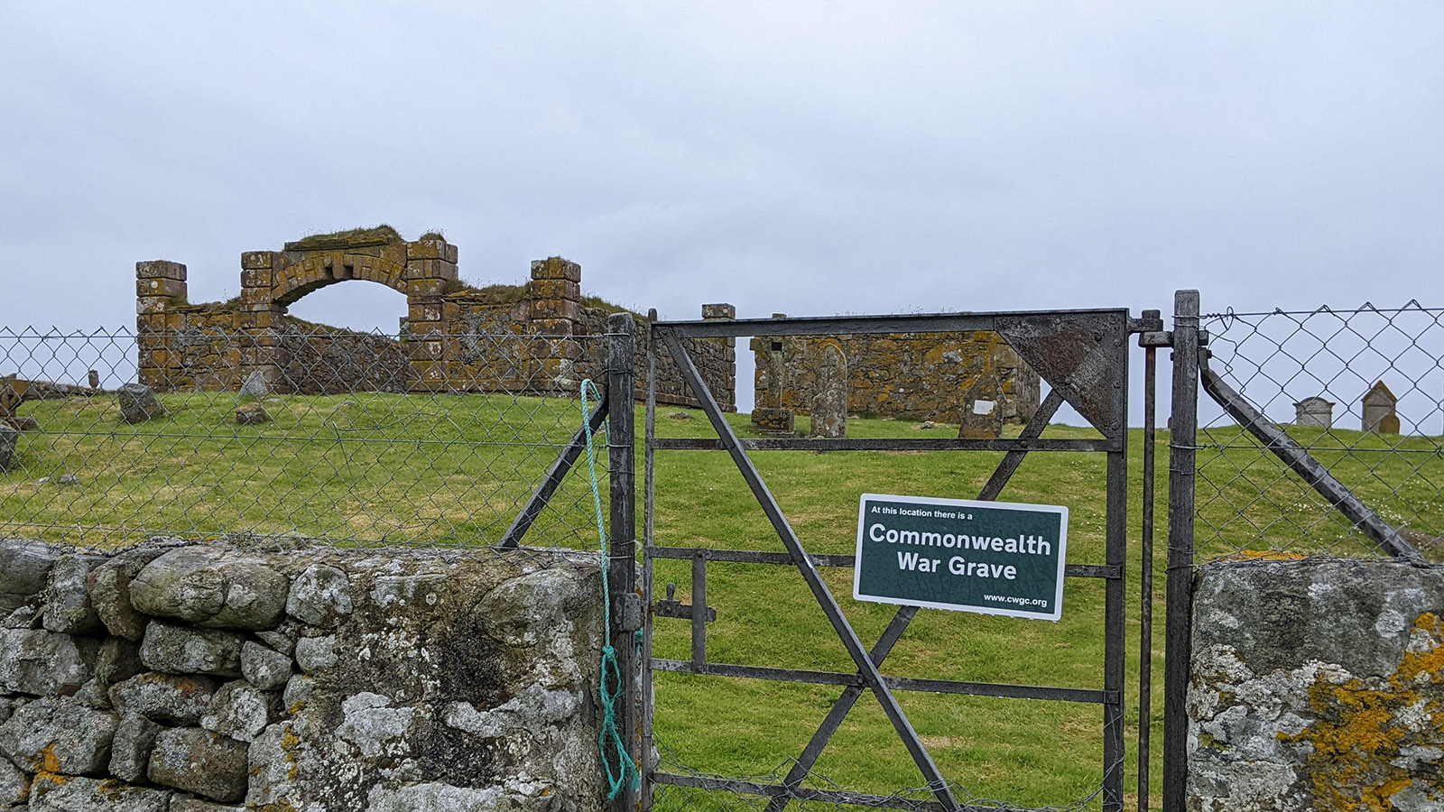
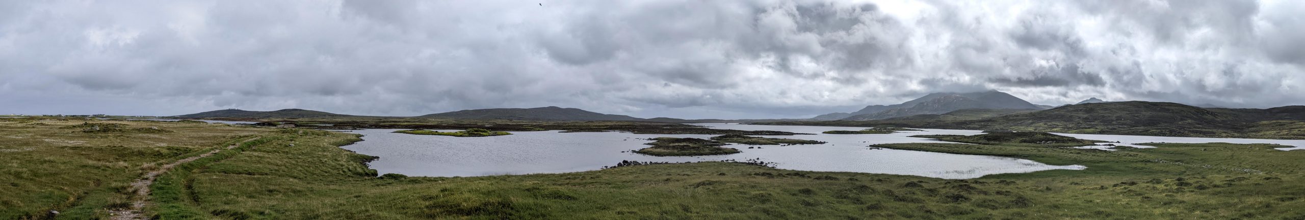
Then I step on the third island of my trip and the largest one so far: South Uist. Here, I still have a solid 30 km ahead of me. It’s all flat, but not terribly exciting. Long beaches, but even longer field and meadow paths without much variation. Since there’s almost no windbreak, it’s hard to find a decent place to rest. Eventually, I find some refuge in the ruins of an old chapel or cemetery hall, where I have my lunch among the graves. However, I realize that I stupidly left my sandwich in the fridge at the Hillside B&B. Doh! So, it’s just an apple, a Twix, and a few Walkers chips.
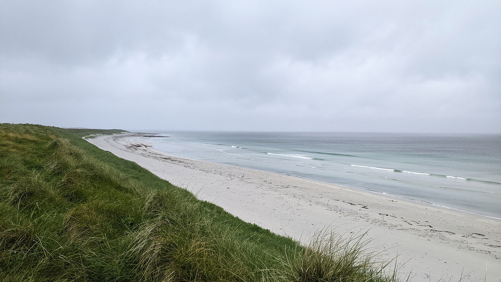
As the afternoon progresses, the rain finally eases up a bit, and I can enjoy the walking more. There’s no company except for a few farmers in the fields; I hardly see another soul. Even the long white beaches are completely deserted in this weather. So, I settle into the rhythm of one step after another and leave the miles behind.

There are plenty of birds: lots of oystercatchers and many others I don’t recognize. In addition, there are plenty of rabbits that have dug their burrows in the dunes. A huge black bull (with a ring in its nose!) makes me hesitate on one of the many pastures I need to cross, but fortunately, he’s not right by the exit gate, so I can make a respectful detour around him.
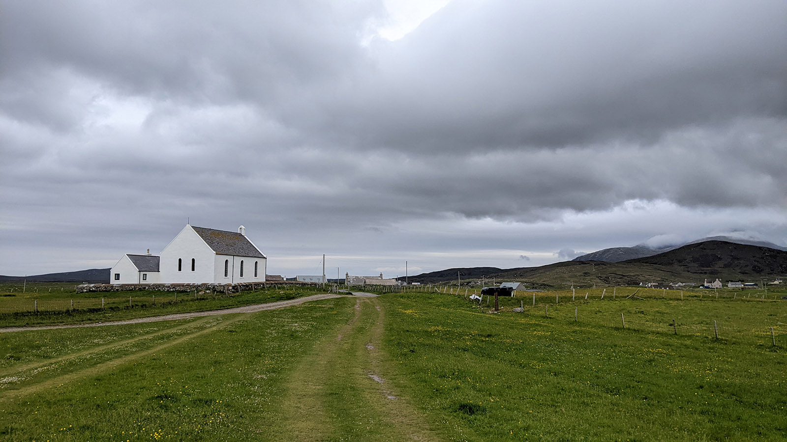
Finally, I reach the day’s destination, the chapel in Howmore. Here, there are ruins of various medieval churches, but luckily, there’s also the mentioned modern chapel. I have half an hour until my taxi arrives, and I get cold quickly in the wind when I’m not moving. Fortunately, the chapel’s vestibule provides shelter from the wind.
And then my taxi arrives and takes me to my hotel, which is quite a bit further south. Really far south; we drive for quite a while. Did I really walk all that? I guess so. The Borrodale is a classic British country hotel, but most importantly, it has a hot shower and food. The island scallops are excellent, but the breaded scampi from Barra not so much – the scampi seem to have dissolved in the frying oil. Regardless, it fills me up, and I’m ready for the next stage (well, I still need some sleep). The weather is supposed to be better tomorrow before it gets quite stormy on Friday and Saturday. Let’s see how that goes. Until then!
Day 3 – Howmore to Liniclate
Images of the Day (Google photos)
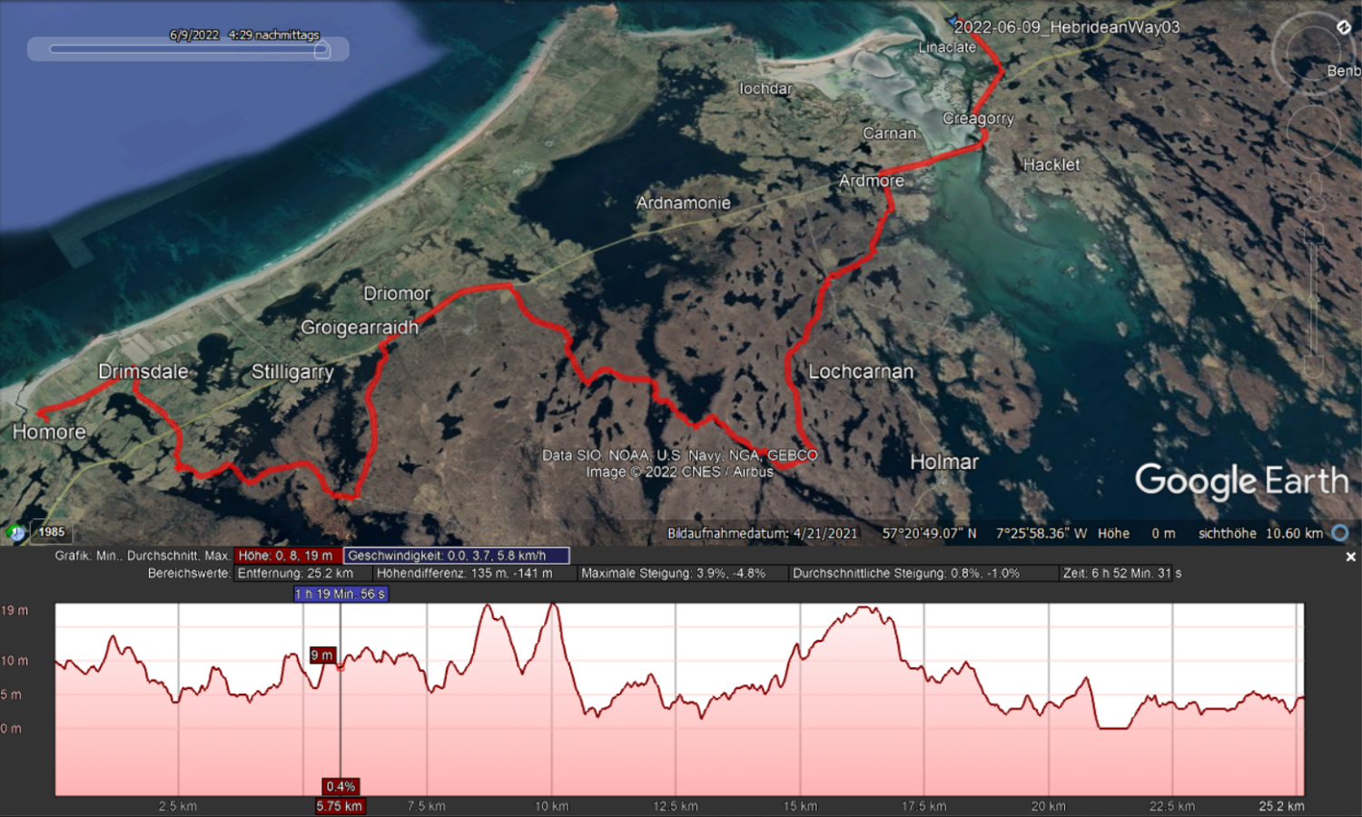
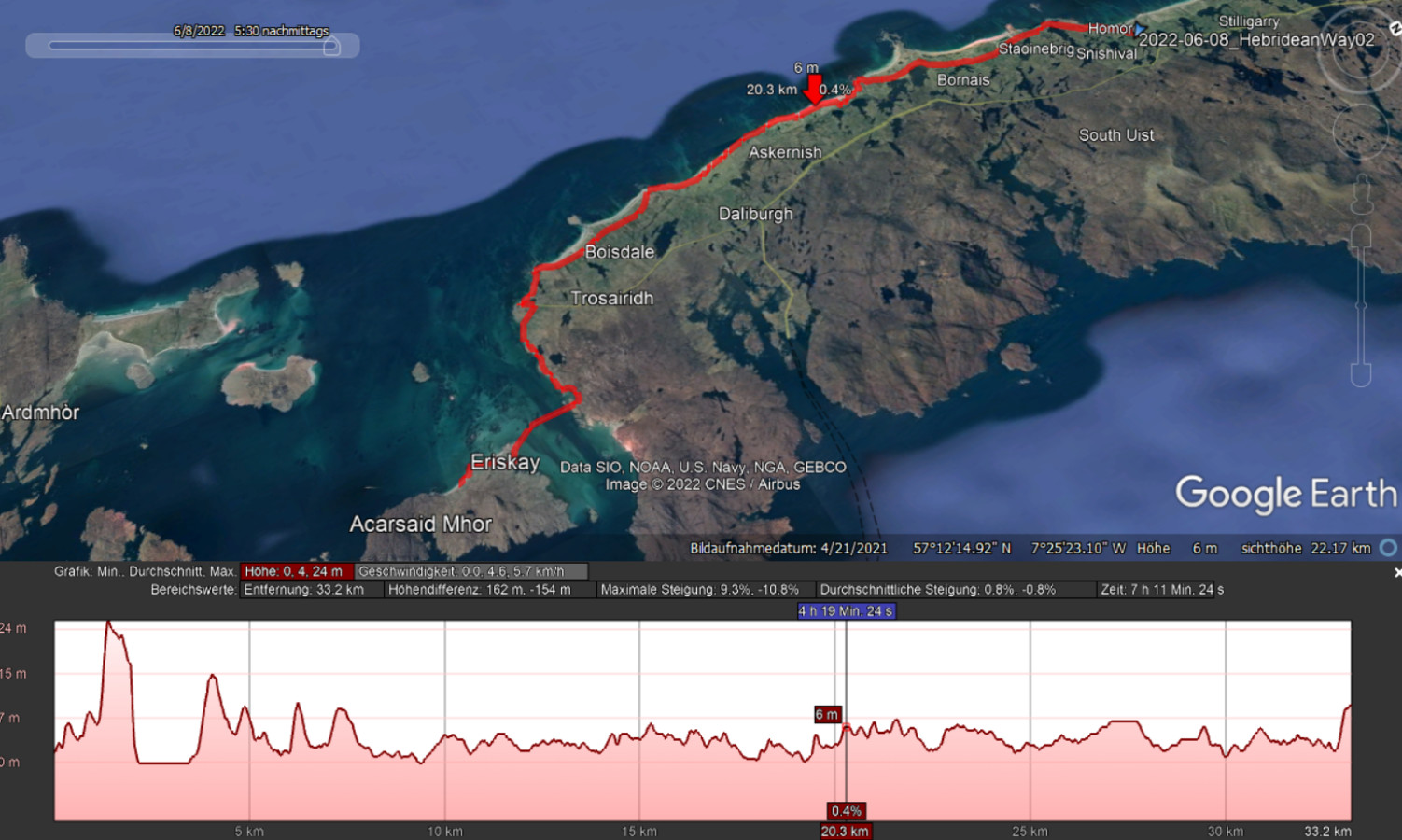
Today, I’m a bit ahead of schedule with the report, as the “promised” 29 kilometers turned out to be only 25 kilometers – I have no idea where the missing four kilometers went; perhaps I unknowingly took an unrepeatable shortcut. Now, I’m here at half-past seven, already had dinner, prepared the pictures, and have plenty of time. Don’t worry, it won’t be a novel, despite the extra time.
Breakfast at Borrodale is unspectacular, but they provide a very generous, complimentary packed lunch – quite delightful! Additionally, I meet my first confirmed co-walker on the Hebridean Way, but he has only come to the hotel for breakfast as he was camping nearby. Not the most comfortable choice in this weather. It seems to have rained quite a bit during the night; at least the roads outside are wet. Tomorrow is supposed to get really unpleasant, with winds up to 80 km/h and some rain showers. Not the best weather for hiking, let alone camping.
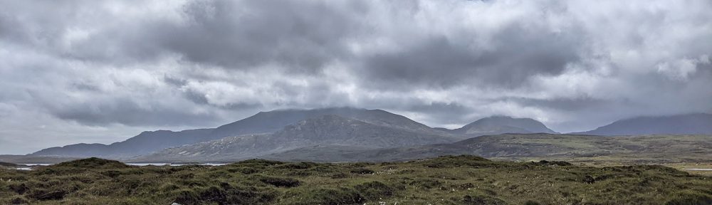
Signs of better times.
My taxi picks me up at 9:30. I won’t get to know the driver’s name, but even if he told me, I would probably have difficulty understanding him. He has a strong accent and mumbles, making conversation quite challenging. It’s still raining on the drive back to Howmore, but I do understand, at least, that he thinks it will soon improve. Initially, it doesn’t seem to be the case when I get out, and I have to put on my rain jacket. However, it does get better soon, and I can finally pack away the rain layer for the day. The sun even comes out, and the morning turns out quite beautiful.
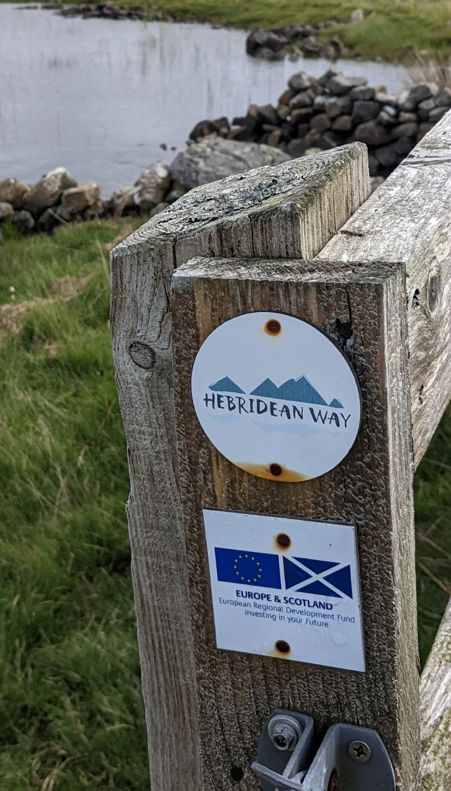
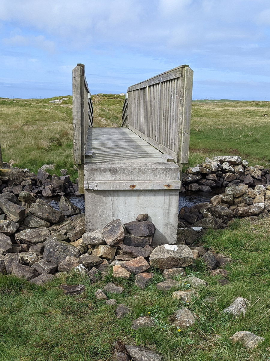
I walk for a while through the “Machair,” the belt of sandy but fertile fields along the coast. The Hebridean Way then veers into the moors of the island’s interior. The path is well-maintained, and at the first bridge I come across an “EU funded” sign, which they haven’t removed here, unlike in Cornwall. However, the funding has long since ended as I realize on the other side of the bridge. Here, the end of the bridge is missing, and I have to climb down over some loosely piled stones. Apparently, there’s no budget for repairs anymore. I encounter several such bridges and boardwalks during the day in various states of disrepair.
On the other side of Loch Druidibeag – that’s the name of the lake in the middle of the moor – I pass a sign at a visitor’s parking lot, indicating the damaged bridge. An elderly couple asks me about the condition, and I explain that I had to do some climbing but could cross the bridge. In hindsight, I wonder if I should have emphasized the “climbing” more – the two didn’t look very fit. Hopefully, I didn’t send them on a futile expedition.
I walk along the road for a stretch, passing the statue “Our Lady of the Isles,” a nine-meter-high Virgin Mary funded by the island community. Yes, they are predominantly Catholic here. She gazes from a slightly elevated position below a radar station across the island, but I skip the ascent and just wave to her from a distance. I think she doesn’t mind.
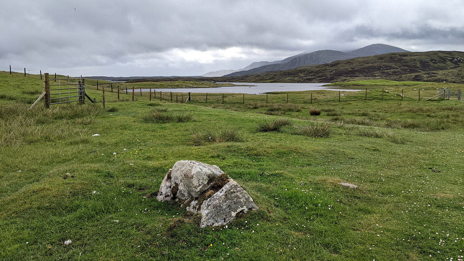
Then, there’s a second, larger detour into the moor, this time along Loch Bi. Here, too, the EU funded the path, and it starts off well paved and clearly visible. However, even EU funding only goes so far, and eventually the path turns into a hardly discernible trail through the moor. This is where the wayposts come in handy, always indicating the direction of the path, but I also have to be constantly on the lookout for the next mud hole disguised by the grassy surface or I’ll sink ankle-deep into the mud. At least, it’s only ankle-deep; I can imagine it gets much deeper here in the spring and autumn.
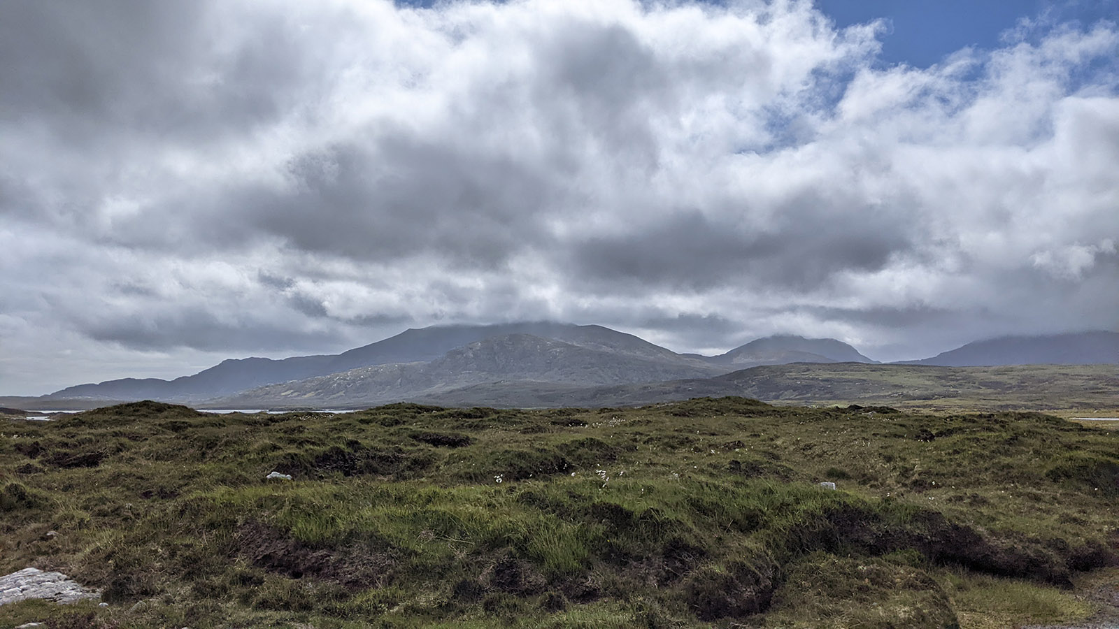
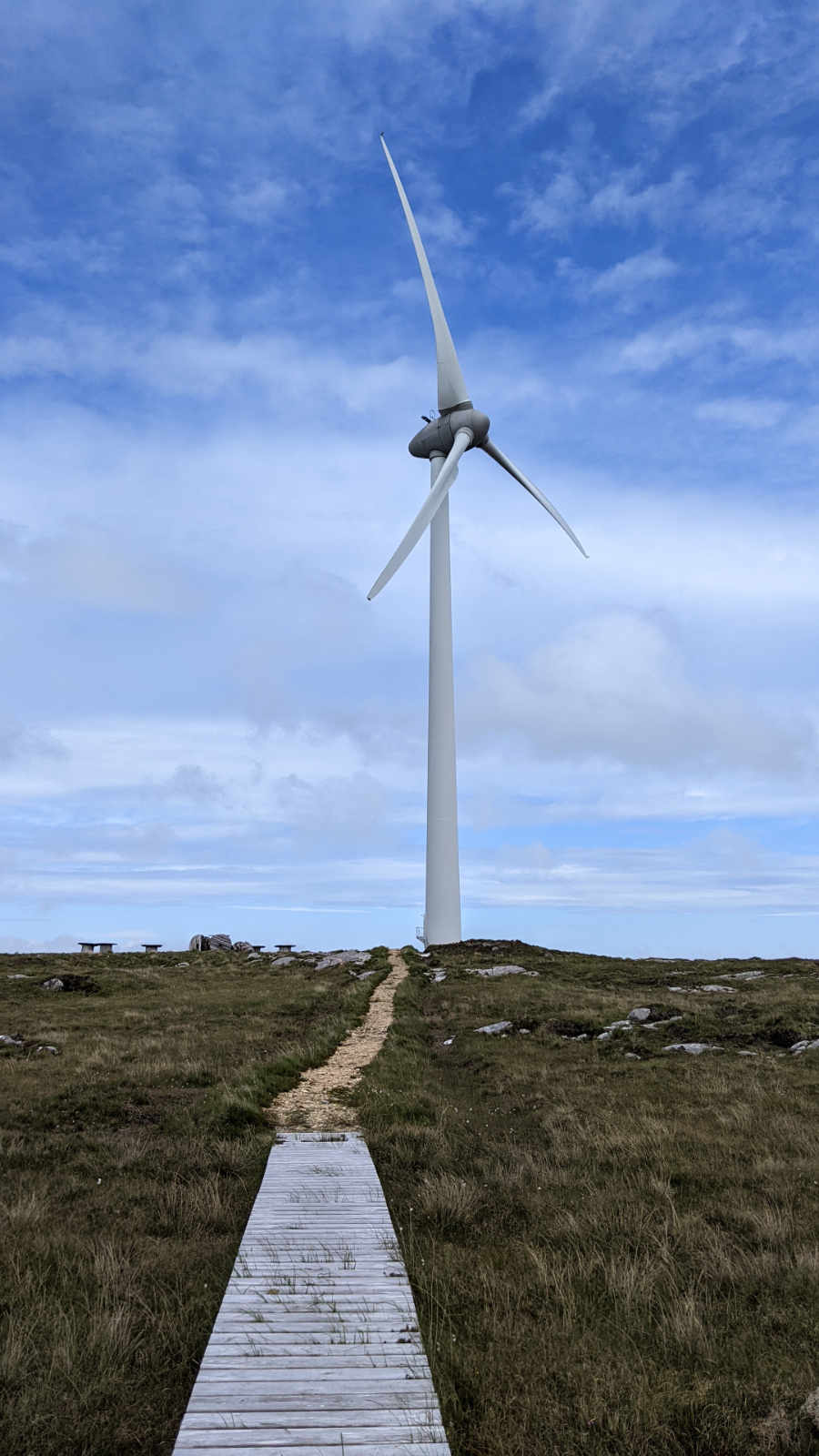
I have fantastic views over the loch to the north, where the flat north of South Uist stretches into the distance, and to the south, where the hills rise. In a small depression, I can even take a relatively sheltered break and raid my packed lunch. However, I still don’t meet anyone along the way, probably because the Hebridean Way is mostly walked from the south. The path later turns into a rocky trail and leads to a group of three wind turbines, from where it continues on the access road. Unfortunately, this road is paved with coarse gravel that might be great for trucks but is hell on a hiker’s feet. For two or three kilometers, I stumble and curse my way along this path, but there are no alternative routes.
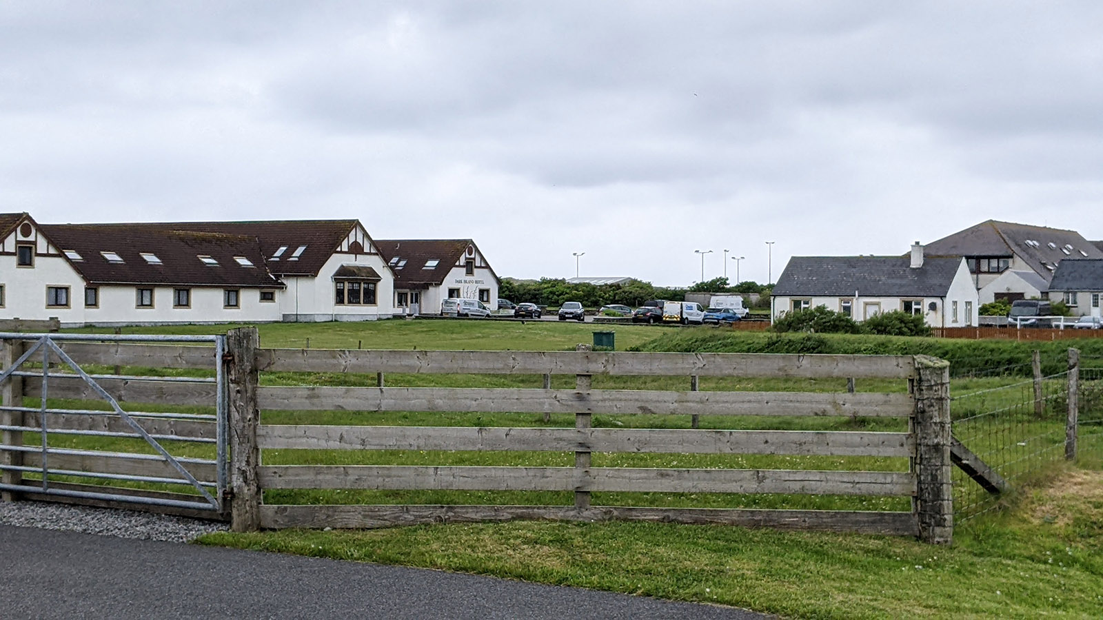
I’m genuinely relieved when I finally reach a properly paved road, even though I have to walk along it for almost the last quarter of the hike. This is the downside of long-distance hikes in less developed areas: sometimes, there’s simply no alternative to walking along the main road. Behind me, the clouds are gathering again as I reach the next causeway and leave South Uist behind. The next island is the small Benbecula, located between South and North Uist. It’s not far to the Dark Island Hotel, where I’ll spend the next night. “Dark Island” is a name for Benbecula in Gaelic poetry, as Google informs me.
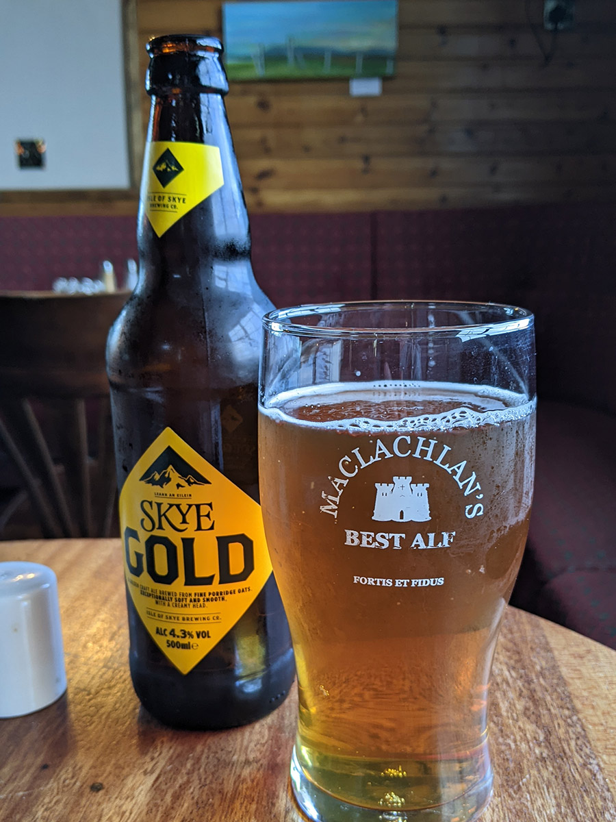
The hotel is a sprawling building, almost as big as the local combination of secondary school, sports, and community center next door. It’s also bustling, and the server in the restaurant adds to the tension with a certain sense of haste. Even with my age, I’m probably about 10 years below the average age of the guests, not exactly a youthful clientele. But the Thai Fish Curry is good, and I get myself a tasty Sky Red for dinner.
Checking the weather forecast for tomorrow makes me ponder; it doesn’t look good at all. Should I skip a day of hiking? But Saturday is expected to be stormy too. Let’s see, I’ll just stick my head out the window tomorrow morning and see how it feels. At least, it’s only supposed to be rain showers, not continuous downpour. If it’s too nasty, I’ll just take the taxi to my accommodation, which also delivers my luggage. But I’ve survived bad weather on other hikes before.