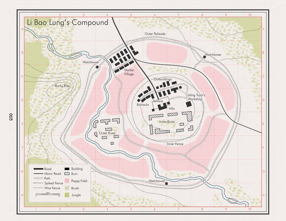
After doing the front and back cover maps for the Fall of Delta Green, I was happy to get back to this awesome game for “The Borellus Connection” campaign by Gareth Hanrahan (with Ken Hite). It’s available now from Pelgrane Press as a pre-order for the physical book (you get the finished pdf right away).
Combining the Cthulhu Mythos of Delta Green with “French Connection” style crime thrillers, the campaign takes you in a drug-fueled nightmare from the haunted jungles of Laos and Vietnam via the underworld of Marseille to (un-)familiar streets of Baltimore and beyond. Just reading it makes me want to run a GUMSHOE-style game again!
I’ve created several maps for this book, from the big overview maps showing the flow of the heroin trade around the world, to smaller locations within the individual adventures.
For some I was able to re-use the base world maps I had created for the FoDG rulebook, for others I set up a new style in Campaign Cartographer 3+, reproducing military tactical maps of the era. This style is available as part of the Cartographer’s Annual Vol 16 now.
I highly recommend The Borellus Connection as another excellent role-playing campaign from Pelgrane Press, Gareth Hanrahan and Kenneth Hite.
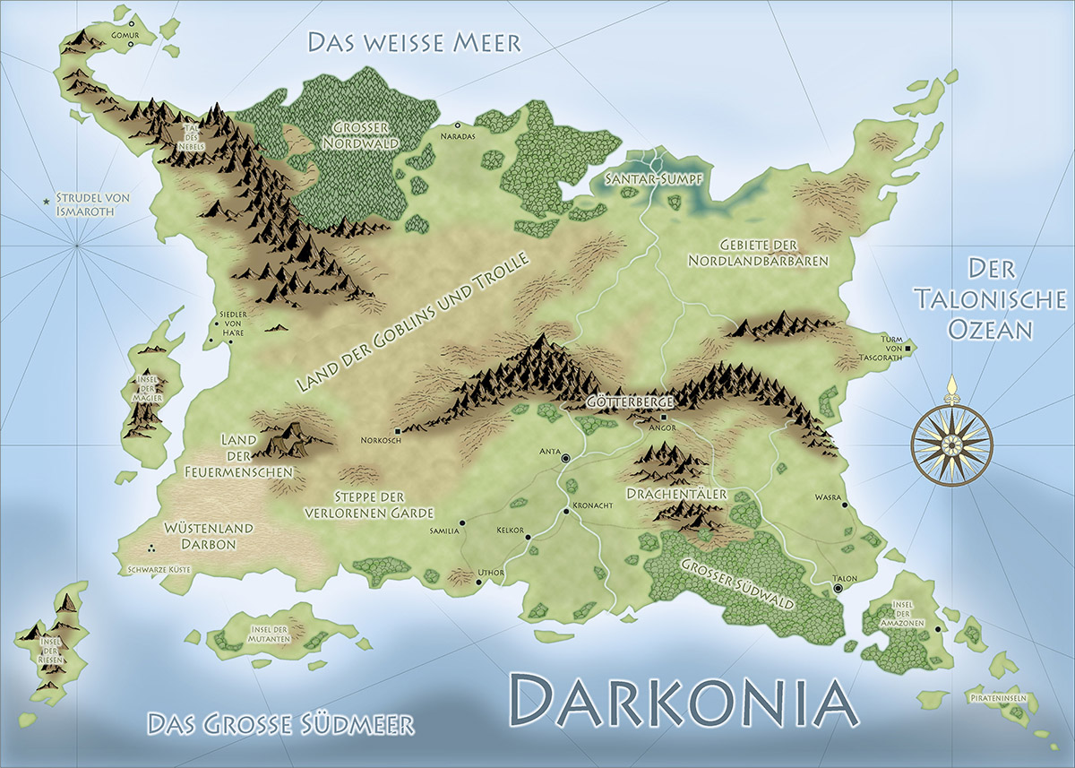
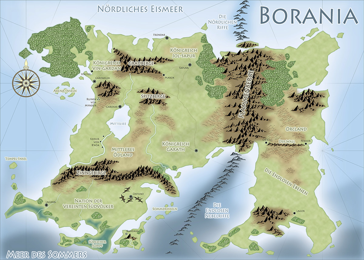
In my line fo work it’s always interesting and a little surprising if a customer contact doesn’t come via the web or social media, but through more traditional channels. A while ago the regional newspaper ran an interview with me, and shortly thereafter local author Samuel Sommer approached me to create some maps for his books.
He had some pretty good drafts for the maps, a style was quickly chosen and so I got to do two small maps of the fantasy realms of Darkonia and Borania. It’s always a pleasure using Pär Lindström’s Fantasy Worlds style, so I was happy when Matthias chose that style, and we soon came to a result we were both pleased with.
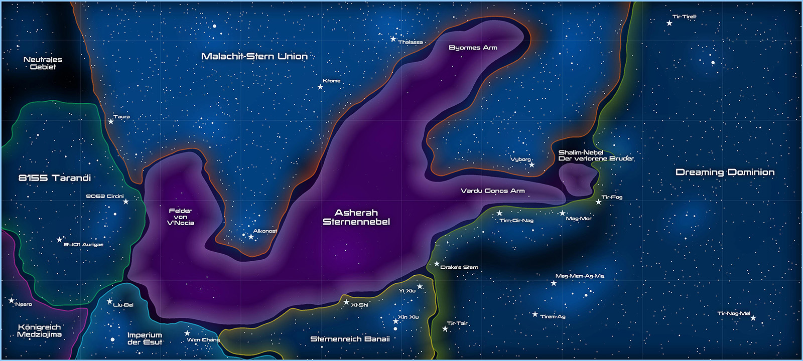
A little later he came back with the commission for a third map, this time for a science fiction novel. Cosmographer 3 has a number of beautiful styles, and I am very fond of its large-scale Galactic map style, which I got to use here, for the Ashera Star Nebula.
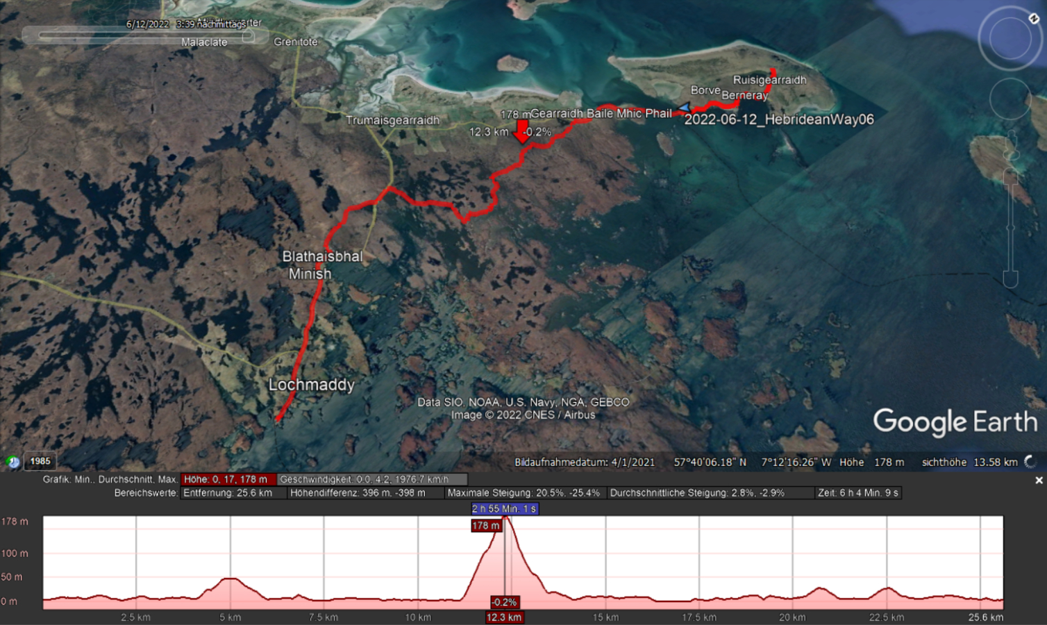
I’m on the trail again, hooray! After actually joining the Ceilidh at the Community Hall last night (impressions here), I have to admit that the dance music for the 70+ year-olds wasn’t quite my thing, and I quickly returned to the hotel. Today I woke up well-rested and early. So early that I was half an hour too early for breakfast. Hm, 8 o’clock? I had breakfast that early yesterday. No, today it starts at 8:30. Okay, I’m a bit confused. But it doesn’t matter; the ferry doesn’t depart until 4:30 PM, and I have plenty of time for the 17 kilometers to get there.
No matter the time, the smoked haddock for breakfast is delicious. There are no lunch packs here, but there’s a village store a short walk up the road where I can stock up. So, I check out, take a quick look at the ferry that arrived early this morning, and then set off. There’s the store; I grab the handle, but the door won’t budge. What’s going on here? Why is everything different today? It’s Sunday, you fool! I completely forgot that the week has almost gone by. This might not be easy today. Leverburgh doesn’t have a restaurant or pub, and I was counting on the food truck at the ferry terminal or the local village store for sustenance. There could be a hungry evening in my future.
Going north from Lochmaddy.
Easy to miss this turn.
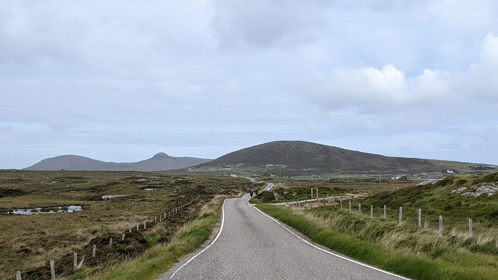
Well, let’s see what can be done when the time comes. I leave Lochmaddy – I really enjoyed it here – on the road heading north. For the first time, I see a small group of hikers ahead of me who seem to be on the Hebridean Way as well. They are walking at almost the same speed as me, so I’m not catching up.
We turn off the road onto the access path to the local water supply to cross the first hill. Shortly thereafter the hiking trail diverges from the gravel road, and I see the three ahead of me miss this turn and continue along the more prominent farm track. Hm, they’re too far away now for me to sprint after them, and the (still strong) wind is blowing directly against me. I have no idea if they have a chance to hear me. Nevertheless, I try waving and shouting, and one of them actually turns around and notices me. Saved, one good deed for the day is done. Well, they would have probably realized it themselves not too far into the future.
A while later, they’re ahead of me again, but as we approach the second, higher hill of the day and a shower rolls in they take cover and I pass them by. I prefer to keep walking in the rain rather than taking a break, unless I can find proper shelter from the wind. The path climbs to the shoulder of the hill and I get my first fantastic views back over the landscape dotted with dozens if lochans.
Lochans-a-plenty.
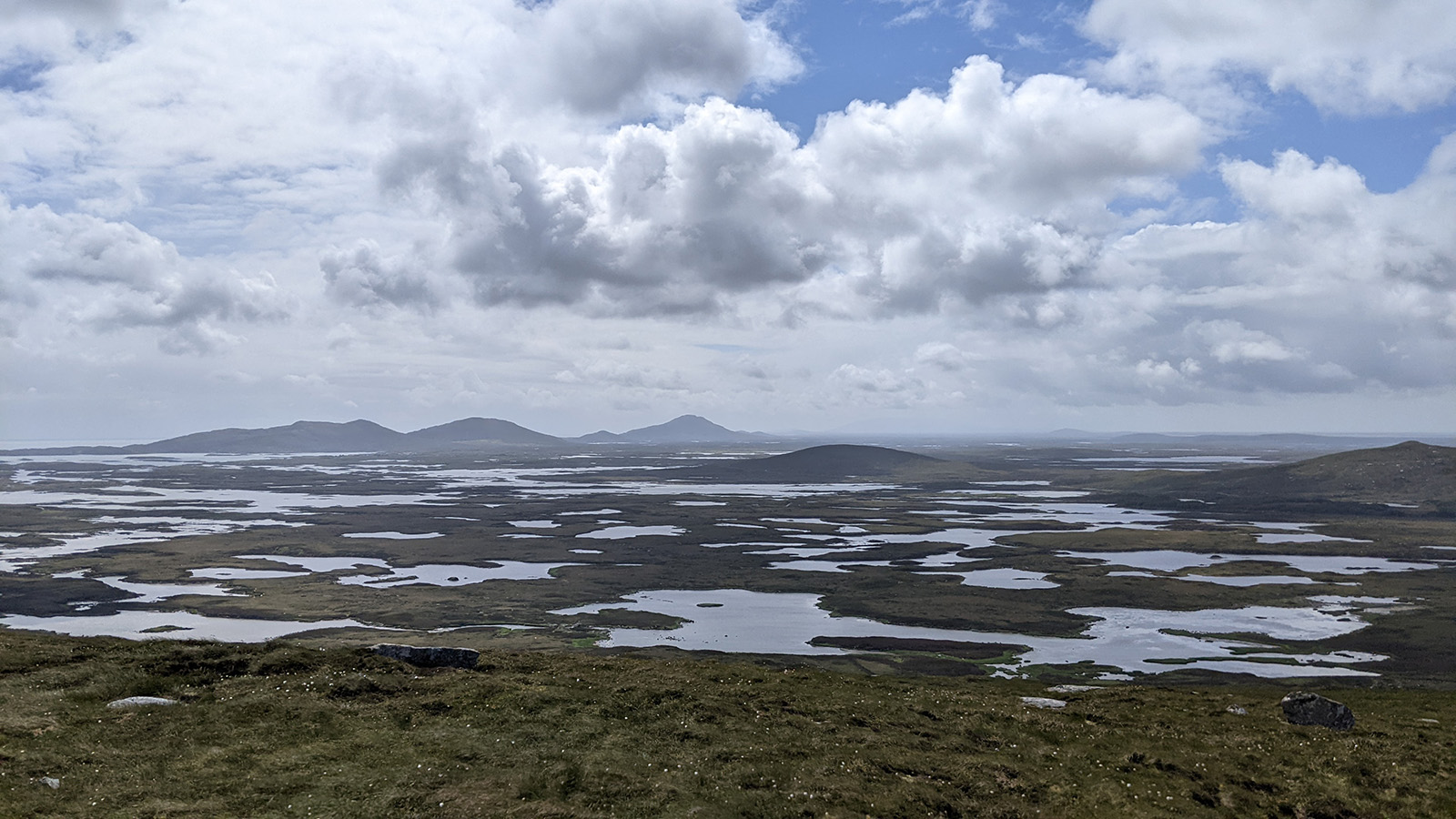
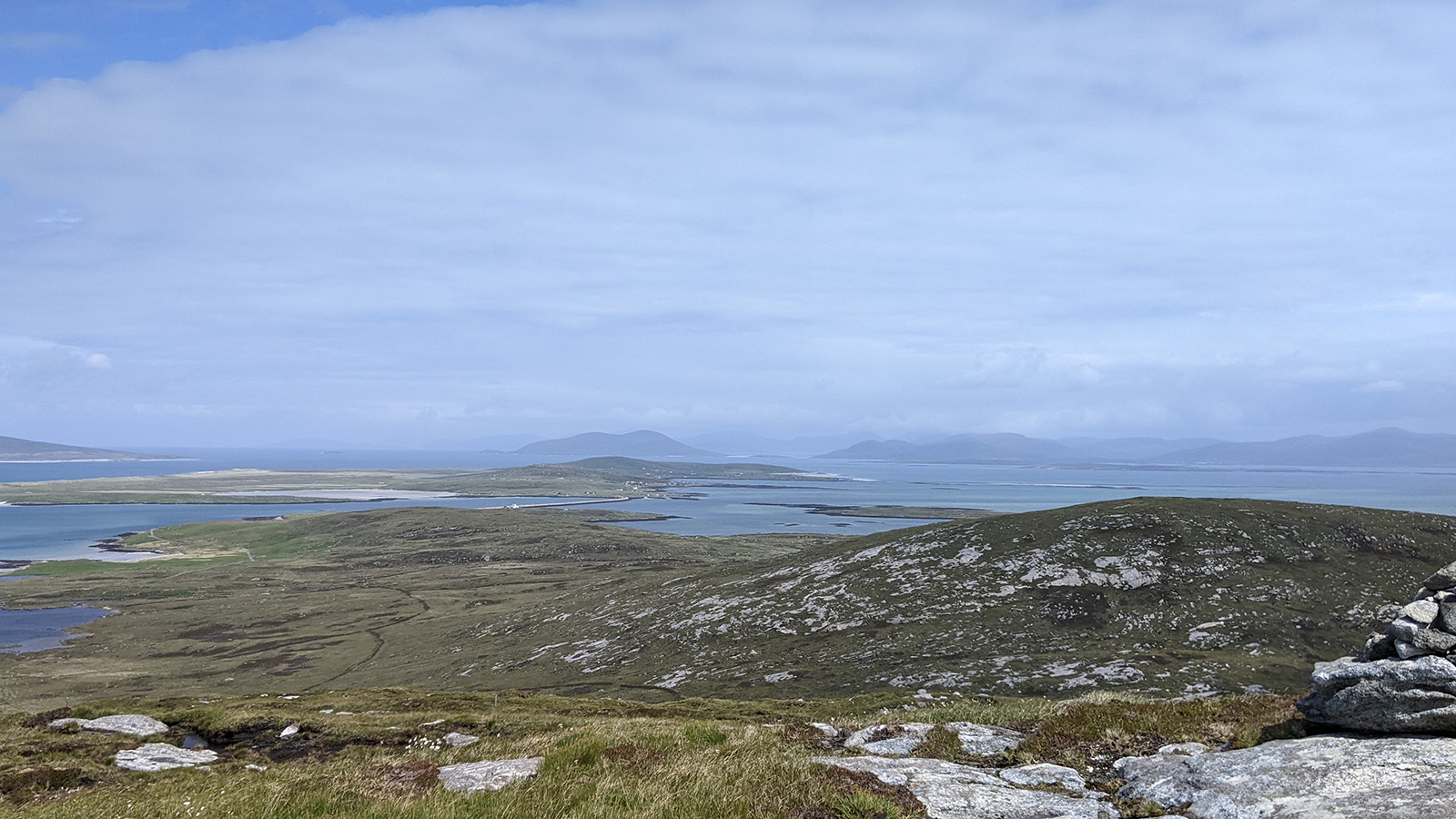
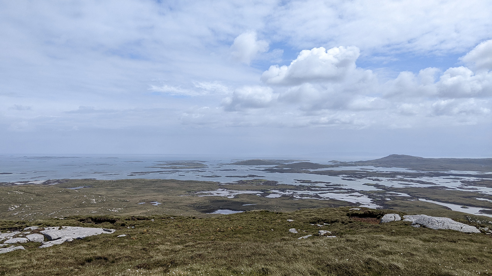
The trail doesn’t climb all the way to the summit, but the hiking guide mentioned that it’s only 200 meters from the path. Hm, should I? Sure, it’s a short day; I should. But 200 meters without a trail up the steep hillside are no joke, and I break the first sweat of th day. Fortunately, the sun is shining right now and reveals an absolutely stunning panoramic view of North Uist. To the south and east, the lochans; to the west, the stunning white-blue shimmering sandy beaches; and to the north, the causeway to green Berneray with the mountains of Harris in the haze beyond. Definitely the best view of this hike and probably one of the best 360° panoramas I’ve ever seen. This is how hiking should be!
South: Looking over North Uist towards Lochmaddy.West: Towards St Kilda and the open ocean.North: Causeway to Berneray and the hills of Harris beyond.East: North-eastern tip of North Uist and Skye on the horizon.
When I can finally tear myself away (the wind eventually forces me to) and I descend the north side of the hill, I can see the next rain clouds roll in the from the west (the wind has shifted today). Oh, I hope the three hikers behind me will also get to enjoy the view. I certainly had the weather on my side.
I still go hungry.
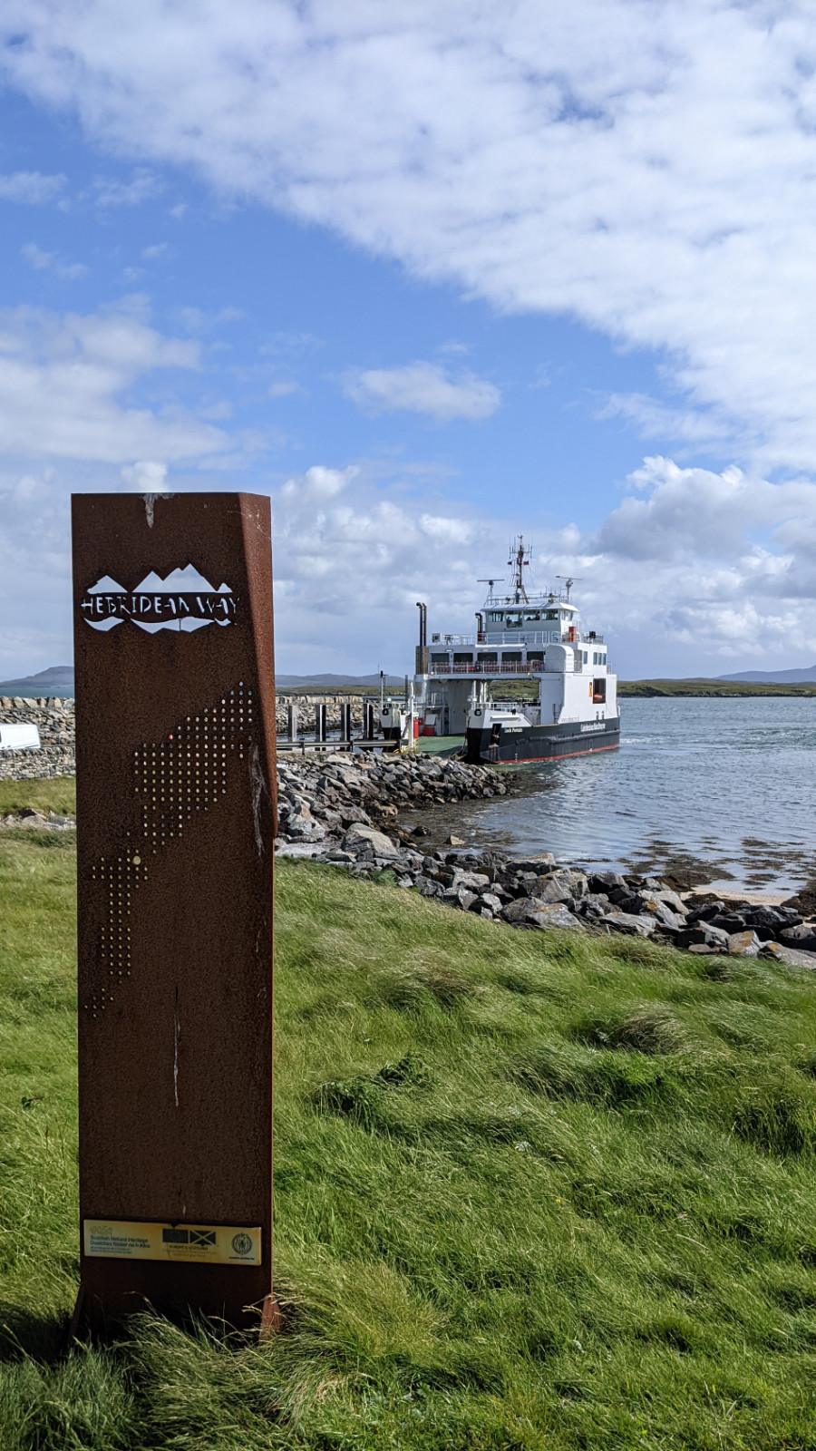
Fortunately the shower is short-lived, and I can tuck away my rain coat before tackling the last causeway of this vacation, the path to Berneray. It’s only 2 o’clock when I reach the island, and the hiking guide suggests exploring the island because it’s one of the most beautiful of the Outer Hebrides. I don’t need to be told twice, especially since I’m still looking for food.
Berneray has a shop with an attached cafe, but who would have guessed, it’s closed on Sundays. Just like the souvenir shop at the harbor, the visitor center, and everything else. Well, the public toilets at the pier are open. Instead of eating, I decide to walk across the island to catch a glimpse of the amazing north beach, but that turns out to be a bit too ambitious. I need to be at the pier by 4 PM to collect my luggage after all. I manage that, but get a bit nervous when the taxi takes its time. I only have a narrow window of time before I need to board the ferry, and I do need my luggage! However, the taxi just as I lose patience and call the office. All’s well!
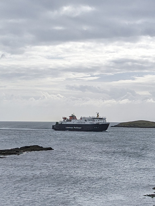
Ferry to Leverburgh.
We board (hm, no sign of my three hikers… I thought they would take this ferry too) and I realize that the ferry is a bit larger than the one to Barra. I get my hopes up: there’s a “Passenger Saloon” and Calmac ferries sometimes have small cafes. Could there be something like that here? No, but there’s a vending machine, at least something … or not, because it’s “out of order.” So, I continue my forced fasting.
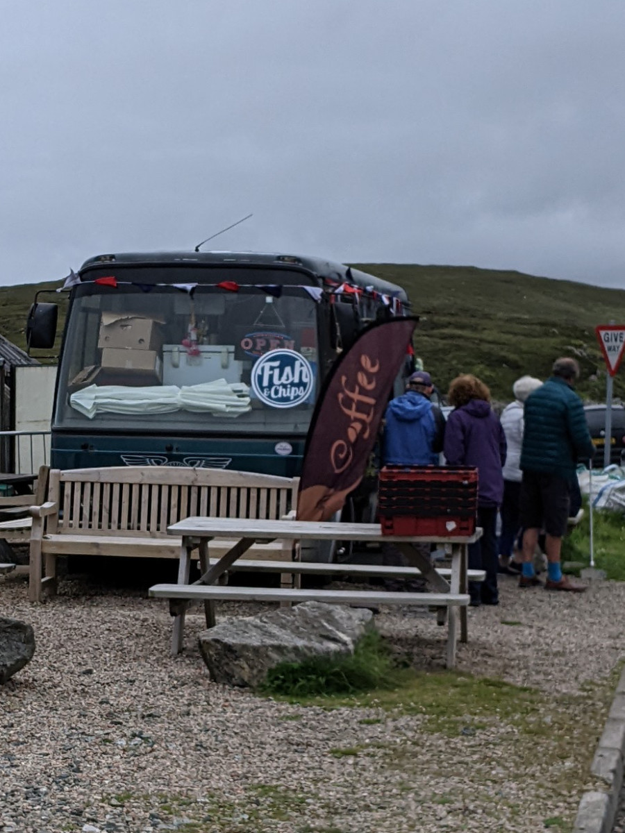
The crossing takes about an hour as the ferry has to navigate a quite complicated course through these waters, filled with many small islands and dangerous rocks. It’s gray and occasionally rainy outside, so I spend most of the time indoors in the “Saloon” until we reach Leverburgh. Right at the pier stands the “Butty Bus,” a fairly well-known and highly-rated food truck. There’s an “Open” sign flashing in the windshield! Yes! No, I’m deceived; it’s not open after all. There’s a sign pointing to the “Anchorage Restaurant,” but that seems to have been closed for quite some time. The only option is to shoulder my big backpack and trudge the last kilometer to Lingay House B&B where I’ll be staying. Maybe they have an apple or a banana left from breakfast.
Not the most glamorous facade, but an excellent guest house inside!
At the door, I’m greeted by Howard, who runs the B&B with his son Jethro, and he welcomes me warmly. When I ask if they might have something to eat, he looks a bit puzzled. “Dinner is at seven.” What dinner? This is supposed to be a Bed & Breakfast, right? Yes, but there’s really no other option in Leverburgh to get dinner, so they decided offer that as well. Wow, it seems like some information got lost between LetsGoWalking and me. Okay, great, that’s fantastic; I’m saved from starving! In fact, they have a proper three-course meal for me and the other two guests (more on them tomorrow): delicious lentil soup as a starter, local salmon on a bed of leeks with potatoes as the main course, and Pink Lady applecrumble for dessert. Truly wonderful.
My room is also lovely, and the sitting room is cozy. I’ll surely be comfortable here for the next two days. Here’s the bad news, though: My planned boat trip to St. Kilda has been canceled; the weather is simply too bad (or the waves too high). From Howard and Jethro, I learn that St. Kilda tours have been going poorly this year; many have been canceled. Overall, the weather is unusually stormy and rainy for the season. Well, there’s nothing to be done about it. I’m sure I can find ways to keep myself busy.
Not a short day, but easy-walking and (mostly) fine weather made it a relaxed one.
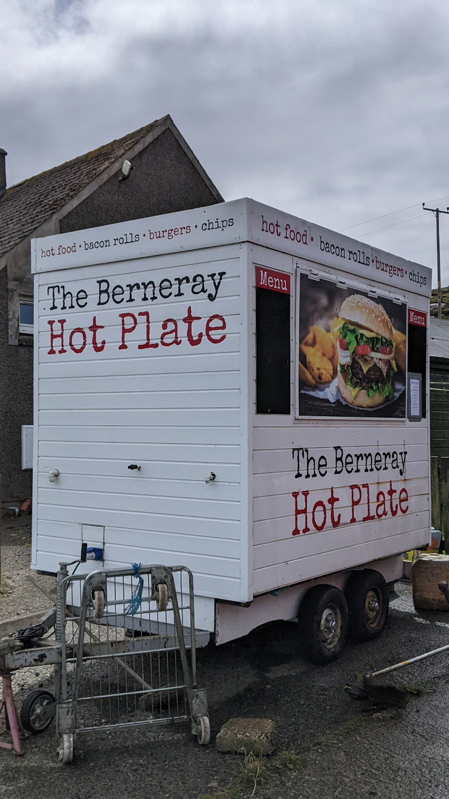
Keeping busy does not seem so easy on the next day though, as there’s not much to do in Leverburgh, the town that Lord Leverhulme once wanted to turn into an industrial center for fishing. A one-hour walk takes me through town to explore the Tweed shop, the Village Shop (including a souvenir shop), the ferry terminal, and the “Butty Bus” at the pier. The food truck does a brisk business with vacationers waiting for the ferry and prepares an excellent soup – on this day, it’s a Tom Yum Squid Soup. Tom Yum is one of my favorites and I really hadn’t expected to find it up here. It makes an excellent lunch!
But the danger of starvation has well and truly past, as the other two guests and I are very well taken care of at Lingay House, and there’s no shortage of anything. Besides me, Richard and Sheila were here on the first night. Sheila is a blacksmith from Edinburgh. She’s cycling the Hebridean Way, but might have overexerted herself a bit. She’s two days behind schedule and quite worried about the next stage (56 km) to Stornoway because she has only managed 20 km per day so far. But if necessary, she can always stop in Tarbert.
Leverburgh and the first hills of South Harris.
No Kilda for us.
Richard is from the south of England and had planned to take the St. Kilda tour like me. Since it’s not happening for him either, he’ll spend two quiet days here in Leverburgh (again, just like me). Walking and cycling are out of the question for him because he’s quite overweight – every time he gets up from the sofa I feel like I’m watching a Herculean task. It’s a shame to hear that because apparently he used to hike all over Scotland and has done many Munros in his time. But he and Sheila make great company and we talk all evening. Interestingly, Richard is currently reading Mick Herron, the author of the “Jackson Lamb” spy thrillers (which I have on my Kindle right now). In fact, on the first day, I manage to complete the second book in the series.
Dinner and breakfast tables at Lingay House.
The sitting (and reading) room.
Sheila leaves us in the morning – I hope she has a safe journey. In the evening, Roger arrives, the new guest. I hear him before I see him and immediately notice that he’s American. “Typically loud,” I think, but I soon mentally apologize (stupid stereotypes) because he’s 86 and hard of hearing, hence the volume. Quite brave to embark on a solo tour of the Outer Hebrides at his age. He’s from Wilmington, North Carolina, originally from Pittsburgh, and obviously in love with Scotland since this is his fourth tour. Talking to him is also fun – if you shout loudly enough – and I spend another pleasant evening reading and chatting at Lingay House.
The only thing that worries me is the weather. The forecast has settled on almost continuous rain from Wednesday to Friday. It might improve slightly after that. Well, there’s nothing I can do about it. For now, I’ll enjoy another day indoors, as it’s already raining most of the time.
It’s 7 a.m. when I wake up, i.e. half an hour before my alarm, and check the weather forecast. Oh, this looks better than yesterday. No or hardly any rain until noon, and even after that, just “light” rain showers. It’s still windy, but without rain it’s only half as bad. So I get out of bed, grab my breakfast, and by 8 a.m. I’m ready to start the day.
The front of the Dark Island Hotel is sheltered from the winds, but as I turn the corner toward the coast I’m hit with the full force of the 45 mph near-storm strength winds. Okay, I’ve had worse in Denmark on the North Sea, but I’ve never hiked all day in such winds. Fortunately, it’s still coming from the south i.e. from behind. However, I have to brace myself for the first few meters towards the beach pushing southward. The loose sand acts like a sandblaster, much like in Denmark.
Low tide beach.
But it’s low tide and I can reach the water’s edge where the loose sand doesn’t reach. Then I turn west and north, and the wind pushes me forward rather than hindering me. So, for the first few kilometers, I alternate between walking along the beach and dune paths along the shore. It’s beautiful and lonely, except for the one hiker I met yesterday morning at the Borrodale. We exchange a few words and wish each other good weather, then I pass him by. Behind me the previously sunny sky darkens, and a light rain shower approaches. So, I unpack my rain jacket and, for the first time put the rain cover on my backpack. I don’t think I’ve ever needed it on this daypack before. But when the rain comes, I’m grateful for it because it really comes down hard and I’m soaked from behind in an instant. As quickly as it started it’s over again, and almost as fast as I got soaked, the wind blows me dry. Soon I can pack my rain cover away again.
Walking along the shore
Summit of Ruabhal
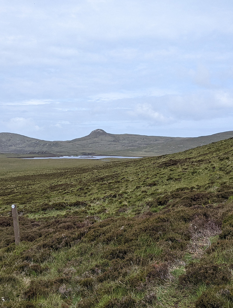
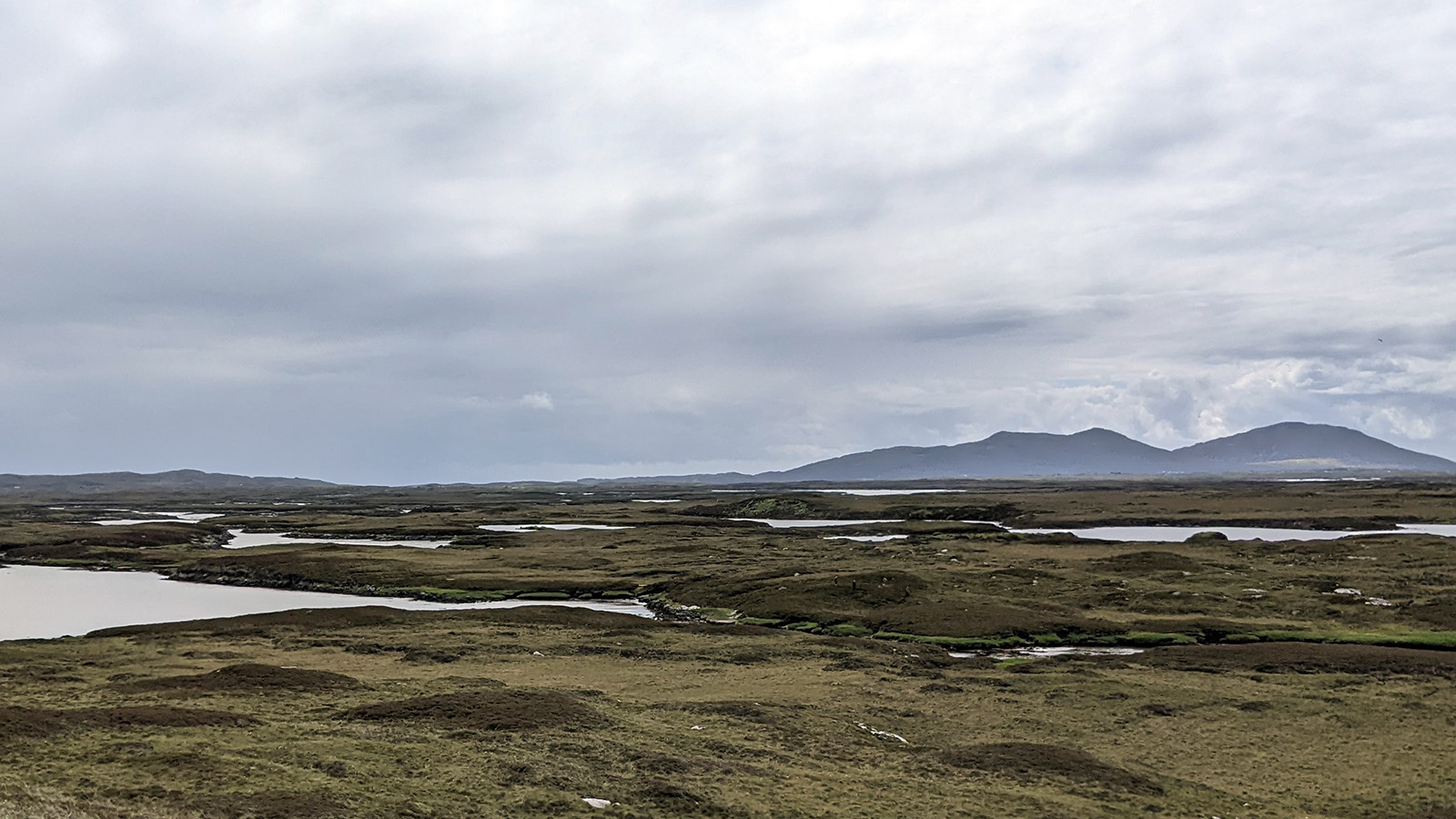
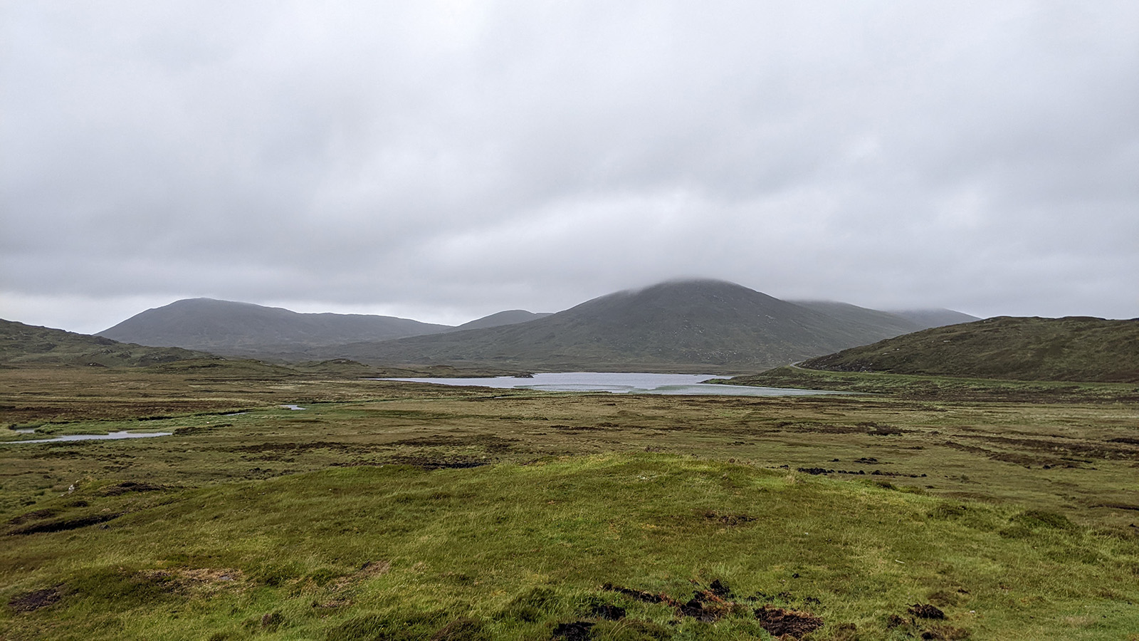
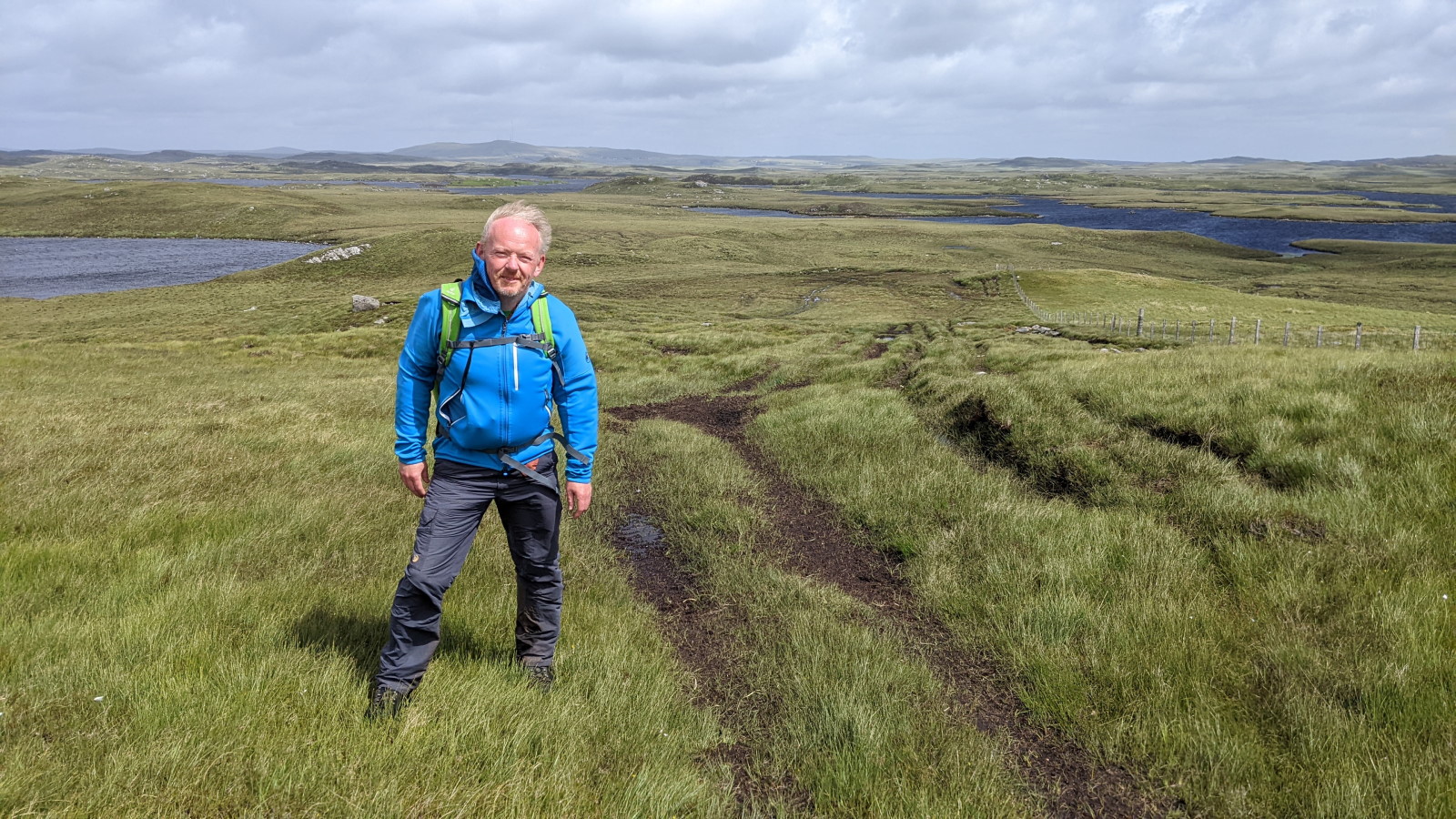
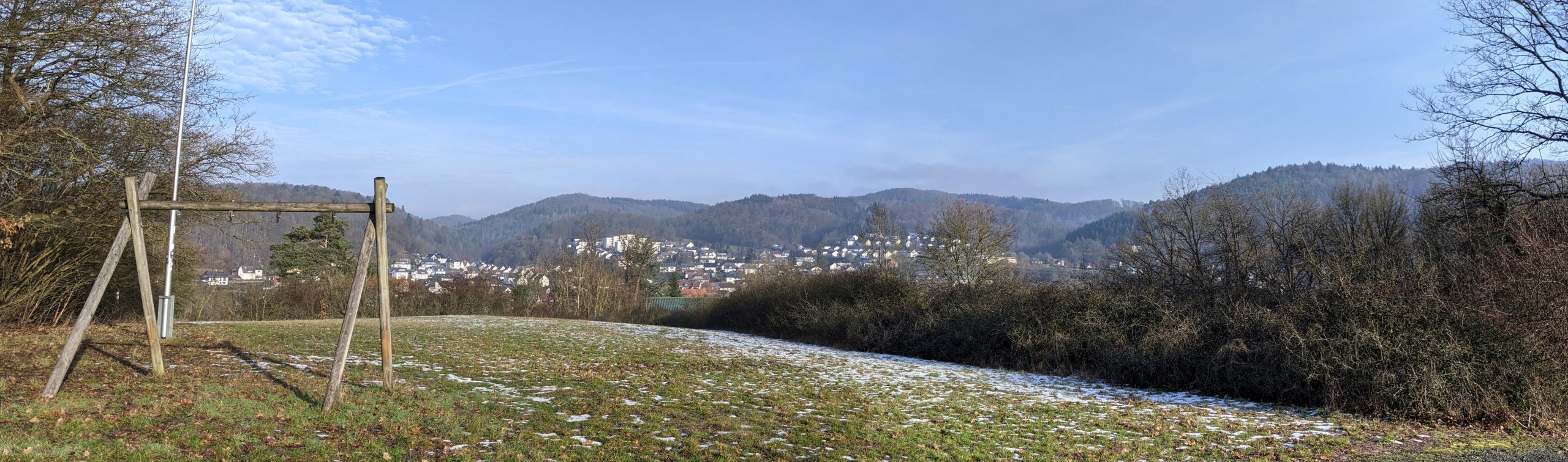
I leave the coast with its numerous oystercatchers, ringed plovers, and seagulls, and head inland toward Ruabhal, at 124m (or so) the highest point on Benbecula. The hill isn’t high, but it stands very isolated in the landscape promising a great view. Thanks to my early start, I have hope of reaching it in good visibility and that turns out to be true. The ascent is far from strenuous, but on top the wind blows even stronger – we’re definitely at 80 km/h, so it’s wind force 9. But the view over the lake-dotted landscape of Benbecula is breathtaking, and I can even make out the mountains of South and North Uist albeit somewhat indistinct. I descend on the north side of the hill and find a somewhat sheltered spot where I can take a break and have a bite to eat.
The path leads me through the moorland between various “lochans” (Scottish for “small loch”), and even though it’s sometimes hard to discern the path (it’s only clear when you’re at least two meters away from it), it’s easy to walk and enjoyable.
The moorland ahead
More invisible otters
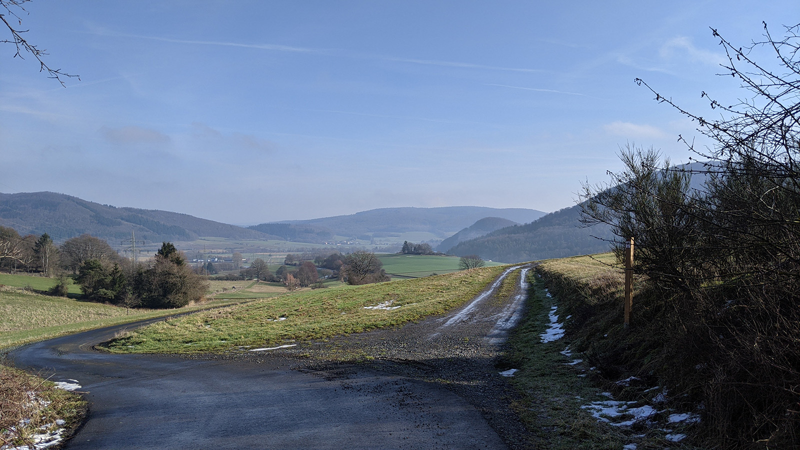
But all good things must come to an end, and I’m back on the road. I know that from here to my destination, there are 8 km along the road and partly on more causeways. On every long hike, there’s usually a low point where I wonder, “What are you doing here? Is this still fun? Why are you putting yourself through this?” I had one of those moments yesterday on the dreadful gravel path, and with today’s weather forecast, I envisioned myself walking 8 km in the rain, completely drenched, unprotected from wind and rain, cursing and lamenting. For now, it looks good; the sun is shining… but a glance over my shoulder tells me it won’t last. The next rain is approaching. So, I get myself ready for the rain and trudge out onto the causeway between Benbecula and North Uist.
And then the rain returns, harder and heavier than this morning, and my pants are soaked again in no time. Why didn’t I bring rain pants? This shower lasts longer, and I can feel it creeping into my shoes from the back. What a nasty attack strategy! Fortunately, both the wind and rain are relatively warm, and surprisingly, my mood remains quite good. Maybe it helps that the first part of the day was so great. Or that I ate something in between. And then the rain stops again, and even before I’ve fully crossed the causeway, I start to dry again.
Closed doors.
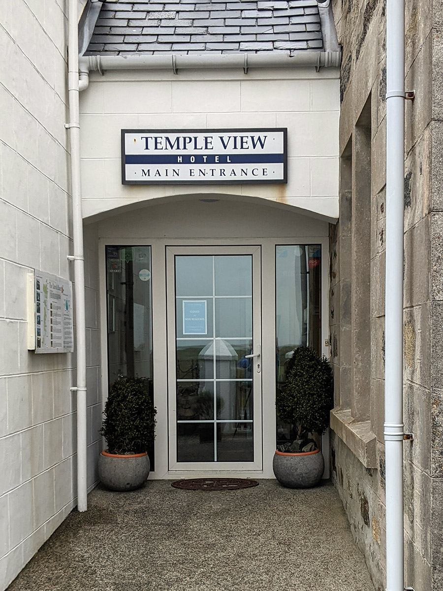
The last few kilometers stretch along the road, but the destination is in sight and I’m early. Thanks to the early start and a brisk pace, it’s only a quarter to two when I reach the Temple View Hotel in Carinish, where I’m supposed to be picked up at 5 p.m. I planned to call the taxi and ask if they could pick me up a bit earlier while I warm up at the bar. Unfortunately, the hotel is closed to non-guests. Damn, what’s the deal with that? So, I call the taxi from behind the shelter of a wall, and fortunately, they can actually pick me up in 45 minutes. But for that time, I absolutely need better shelter. Fifty meters away is a bus stop where two cyclists have already taken refuge from the wind. I ask if there’s some space left, and of course there is.There are even some chocolate cookies for me.
The two (a middle-aged couple) are also traveling across the islands from south to north, although not strictly following the Hebridean Cycle Way. They’re from Inverness, as I learn from the woman. They only have a few kilometers left to their accommodation but had to stop because they couldn’t handle the strong crosswinds. I can understand that; I felt like I was walking at a 45-degree angle at the end and had to be careful not to be pushed in front of the passing cars. They’ve called the friend where they stayed last night, and he’ll pick them up. It’s not long until he arrives but with the bikes and two passengers, he has to make two trips. The husband stays behind, obviously irritated by the weather and the circumstances. Initially he’s very quiet but then he opens up a bit. When I mention Lochmaddy, the place where I’ll be staying for the next two nights, he tells me that there’s supposed to be live music there tonight. Other cyclists they encountered mentioned it. If I were in Ireland, this wouldn’t surprise me at all, but in Scotland, even here on the islands, it’s not so common. I make a mental note; it might be something to check out.
26km in high winds.
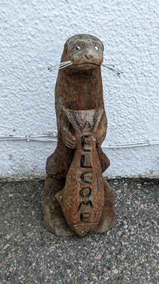
The welcome otter greets me at the Lochmaddy hotel.
Then my taxi arrives, and I can finally get inside to warm up and get dry! Unfortunately, it turns out there was a misunderstanding on the phone. The central dispatch (or better “the wife” of the driver) understood that my luggage was already in Lochmaddy because I assumed it had been picked up in the morning as usual. But it wasn’t; he intended to pick it up on this trip with me. So, back to the Dark Island Hotel, and then finally toward Lochmaddy. I make up the extra mileage by telling the driver he won’t need to ferry me tomorrow – I’m definitely taking a break. The wind isn’t going to ease up by tomorrow and there’s supposed to be significantly more rain. I really don’t need to put myself through that. Conveniently, I’m staying in the same hotel for two nights so I won’t have to move in between.
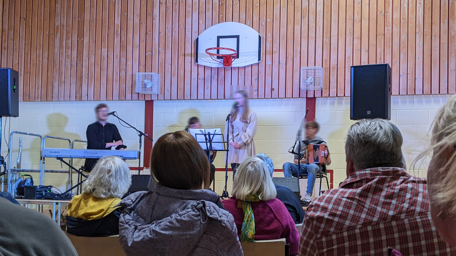
The Lochmaddy Hotel is also great for that purpose, with a nice bar and restaurant. There’s a museum and cafe in town… and live music! Indeed there’s a session with local folk musicians on tonight. So the journal doesn’t end today with my fish and chips for dinner. Instead, I dress up (i.e. I put on clean pants) and walk over to the Community Hall.
Live music under the hoop.
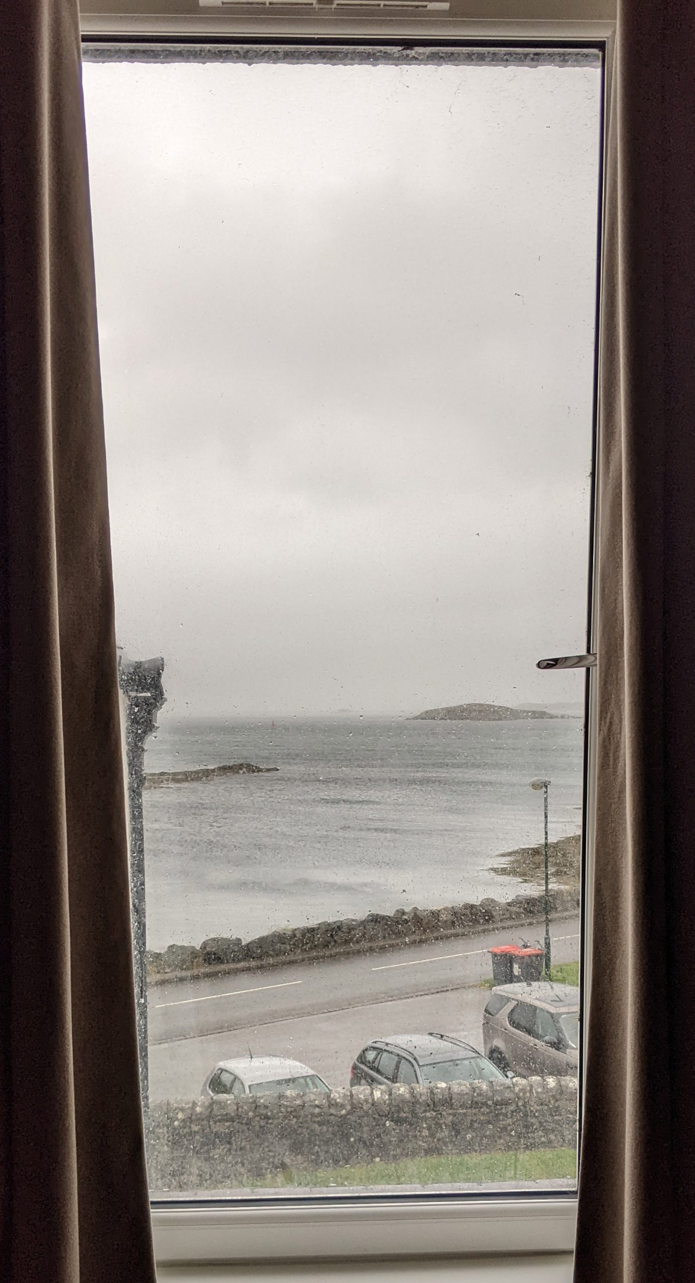
The weather outside.
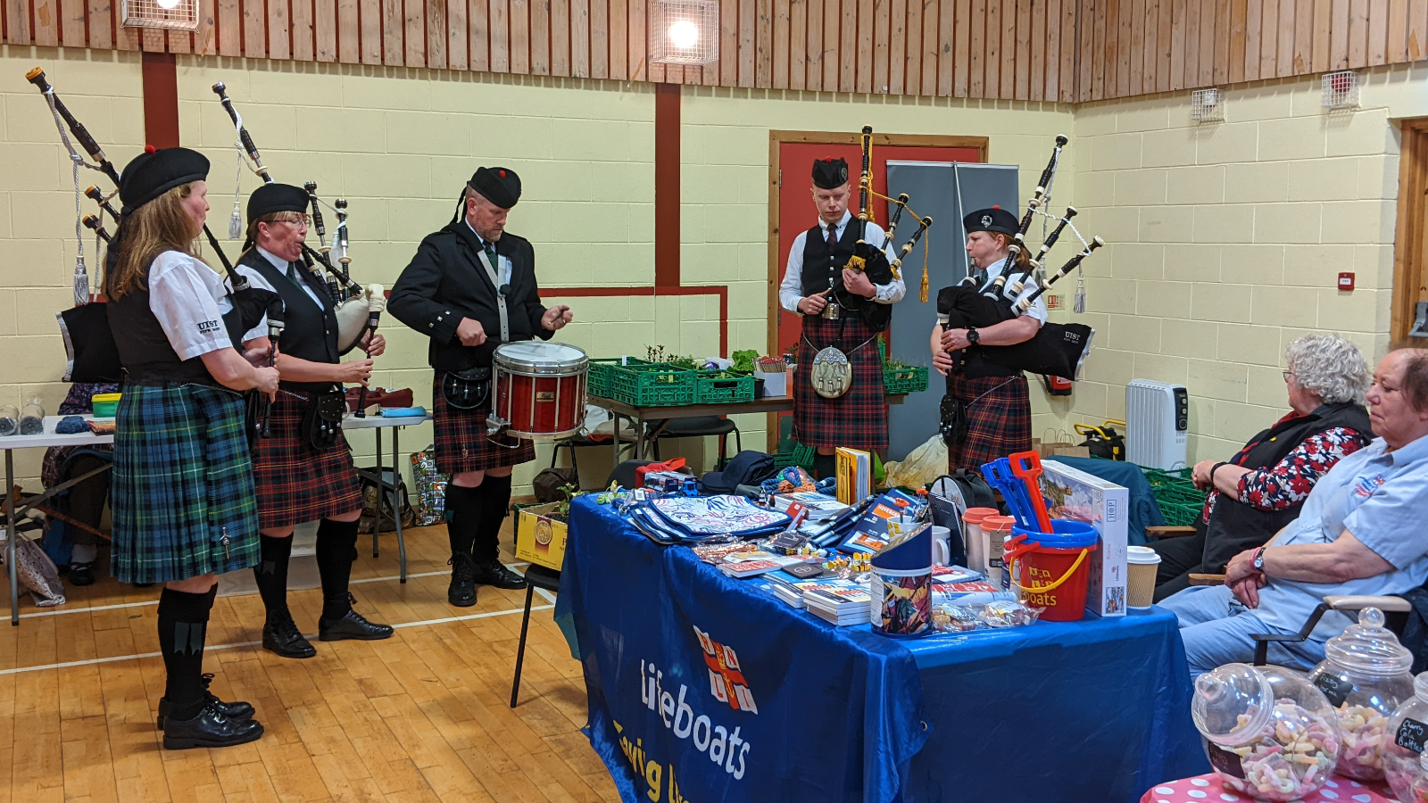
The event has the feeling of a school event (except there’s beer and gin at the bar), not least because the Community Hall obviously serves as a gym as well, complete with a basketball hoop above the stage. This is definitely not Ireland, where this happen at the local pub. The performers range from locally known musicians (Chloe Steel and Padruig Morrison) to music students around the age of twelve, paying tribute to their deceased teacher (with Carpenters’ “Top of the World”). Not everything hits my taste (solo accordion just isn’t my thing), but it’s heartwarming and wonderful. And even though I don’t understand it, Gaelic is an amazing language to sing in. Sheena Peteranna performs last, having just completed her music degree at the University of the Western Isles, and she presents various pieces from her graduation presentation. She’s truly amazing and when she finally plays the great Highland pipes (the “real” version of the bagpipes), it nearly blows the roof off the Community Hall. Interestingly she’s accompanied on the piano/keyboard by a German exchange student from Föhr.
The event lasts for over two hours, and I have a great time. It’s amazing where you end up when seeking shelter from the storm with other travelers at a bus stop. I didn’t see any other advertisements for the event, and most of the other attendees must have been locals. Except for the guy in the second row, who I could only see in profile – I am sure that was Bernie Sanders, of all people, or at least a 99% lookalike. In any case, I trudge happily through the storm back to the hotel, nod at the little welcome otter at the entrance, and retire to the bar for a whisky to write this report. It probably won’t be finished until tomorrow because I have so much to tell!
As planned I decide to skip the walk from Carinish to Lochmaddy today. Every glance through the window and every step out the door confirm my decision – this is not a day for hiking. Instead I enthusiastically dive into the local culture. Once again it is the rumor mill among the holidaymakers that leads me to an interesting event. At breakfast I meet a couple who also stayed at the Hillside B&B in Castlebay. They tell me that is a Community Fair in Lochmaddy today, and a Piper Band will be playing. I can’t find any information about it online, but asking about it at the museum I am told, “yes, it is happening at the Community Hall (again), and the pipers will be playing at 1pm”. Fantastic, that suits me perfectly!
Before that I have some time to explore the Taigh Chearsabhagh Museum & Arts Center. The current exhibition on the “Music of North Uist” is fascinating. I learn that the roots of “Runrig” are here in Lochmaddy. The two founders, Rory and Calum McDonald, were born and grew up here.
Runrig was very popular in Germany in my youth.
Braving the wind and rain I walk once again to the Community Hall and find a mix of craft fair and a flea market. There are attic finds, homemade soap, greenhouse seedlings, sweets, sea rescue charity, and – of course – a raffle. Just no bagpipes or pipers yet. They are late but due to arrive shortly, as I learn from Barbara the affair’s organizer. Indeed, half an hour later four pipers and a drummer arrive and the performance can begin.
Did I say that the Highland pipes almost blew the roof off last night? Multiply that by four and add a drum. By all rights something like this should happen outside, but that is not an option today. Nevertheless, I have a blast though some of the audience flee to the outside hallway to better enjoy the “music.” The small concert is over far too quickly, but as I am leaving, Barbara invites me to the Ceilidh (pronounced “Kay-lee”) tonight – a traditional Gaelic music and dance event. I’ll see whether I can muster the energy for another trek through rain and wind at 8 p.m., but I am intrigued. For now, it’s time for dinner; the pizza at the Lochmaddy Hotel looks good.
Tomorrow it’s back to the plan. The forecast says partly cloudy with no rain, that sounds promising. The day’s walk isn’t very long either, just 17 km to the ferry terminal on Berneray, where I’ll catch the 4:30pm ferry to Harris.
Phew, that was a long day. Almost 8 hours on the trail and 34 km walked, I haven’t done that much in a while. But I made it, and now I’m sitting in the bar of the Borrodale Hotel, enjoying a single malt while typing up the journal. It’s a 10-year-old Ledaig, which I hadn’t tried before. Very peaty, which means it’s not for Mert.
Partly because of this whisky, the report will probably be a bit shorter, as I’m super tired. But at least I don’t have to get up as early tomorrow. Today, I had to catch a ferry…
For the fourth and unfortunately last time, Dan drives me around Barra. He picks me up at 8:30 so I can comfortably catch the 9:25 ferry to Eriskay. This time, we take the west side of the island, and when we arrive at the ferry terminal, I feel like I’ve covered every paved road on Barra. I bid a warm farewell to Dan because it was really nice traveling with him – we had great conversations every time.
As mentioned in the diary of my Black Forest hike (Schluchtensteig), I had planned to hike across the Outer Hebrides for a while, but the pandemic got in the way. Last year (2022) I was finally able to put my plan into action and trekked across the Scottish isles. As usual I kept a daily journal in the form of emails to friends and relatives, and I want to share that diary here along with some of the beautiful images I took on the hike. This time I want to share my experiences with my English-speaking friends as well, and will therefore translate my daily notes.
Also, es geht endlich wieder los, auf eine mehrtägige Wanderung, auf die ich euch ein bisschen mitnehmen möchte. Dieses mal ist es der Schluchtensteig, eine 6-tägige Tour durch den Süden des Schwarzwalds. Eigentlich sollte ich ja auf dem Hebridean Way im äußersten Nordwesten der britischen Inseln unterwegs sein und mir den Atlantikwind um die Ohren wehen lassen, aber eine uns allen bekannte Pandemie hat das verhindert. Aber aufgeschoben ist nicht aufgehoben, und die Hebriden werde ich hoffentlich nächstes Jahr nachholen.
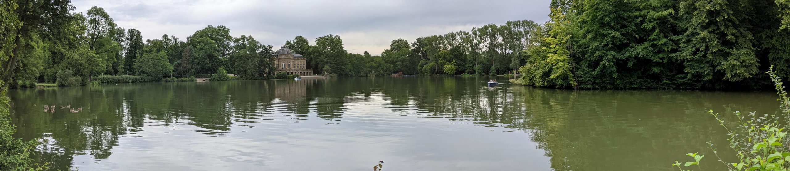
Statt mit dem Eurostar durch den Chunnel zu düsen, bin ich also mit Stef nach Ludwigsburg gefahren und statt meinen alten Ringkrieg-Mitspieler Andrew in York zu treffen, sehe ich endlich die Dänemark-Fahrer Frank, Frank und Heiko wieder. Nach einem gemeinsamen Abendessen beim Italiener, einem netten Abend mit viel Quatschen und einer erholsamen Nacht, soll es dann heute mit der Bahn nach Stühlingen gehen, dem Start der Wanderung. Der Zug von Ludwigsburg geht aber erst um 12:30 so dass Stef, Frank und ich nach dem Frühstück noch Schloss Monrepos anzuschauen, eines der kleineren Lustschlösser der Württemberger Herzöge. Wir wandern um den See und laufen ein Stück des Planetenweges, bevor es Zeit wird, mich zum Bahnhof zu bringen.
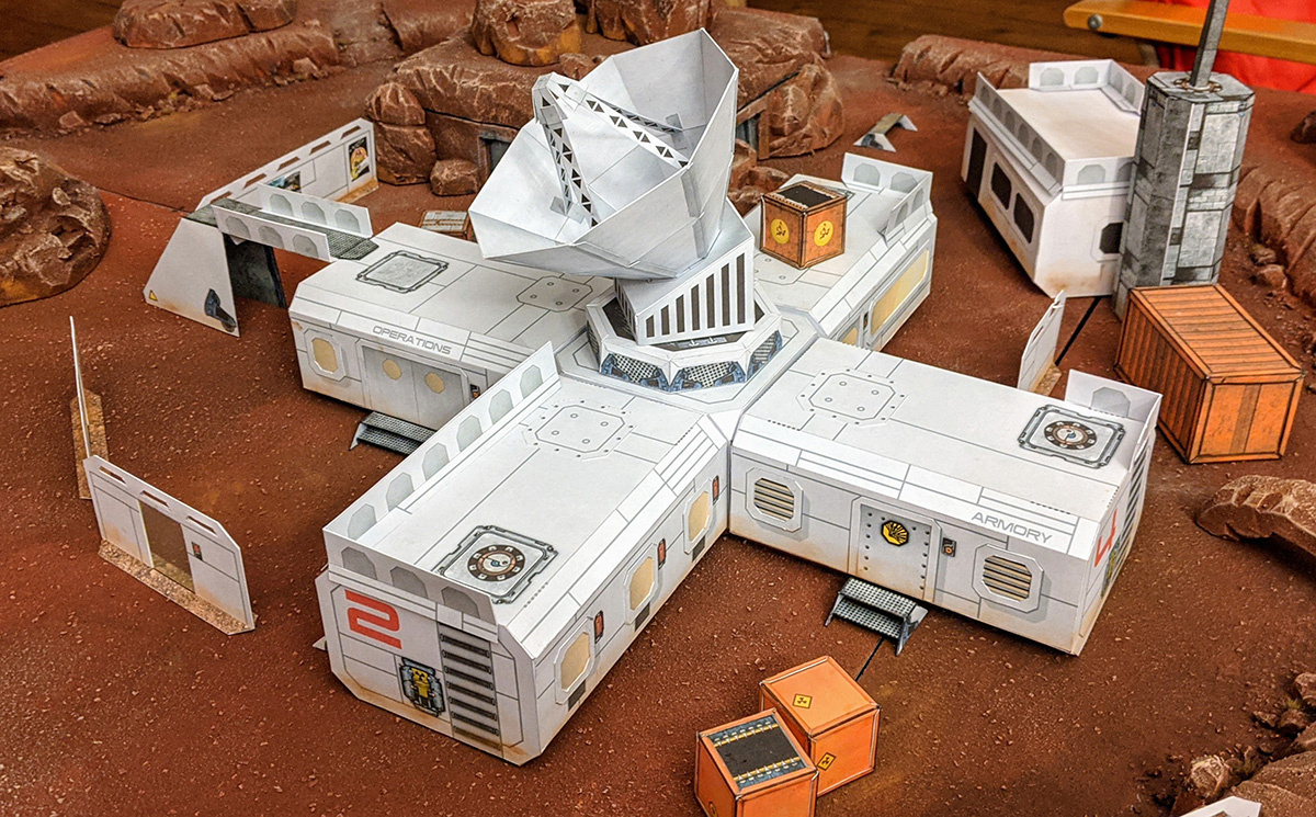
An assembled colonial outpost, waiting for a suitable mission.
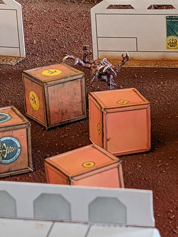
Crates and walls in action, serving as cover for a nasty critter.
Over the past few months I’ve been building up a little collection of papercraft models, designing them in Dioramas 3, and building them for my own science fiction games. As it is now large enough to make quite an interesting and useful collection I thought I’d share them here for general use.
Here I will provide pdf files of the models only. If you are interested in the Campaign Cartographer source files, head over to this thread in the ProFantasy forum. I recommend printing the files to cardstock paper. They are small enough to hold up without additional strengthening. At 100% scale they fit 28-32mm models nicely, but you can simply scale them down if you are playing with smaller (15mm or 6mm) models. I don’t have any assembly instructions, but I hope the photos included in the zip file will make it clear enough. You can see me building the communications tower in time lapse here.
This post is a look at the hobby side of Maps & More (the “More” part), specifically my love of hiking.
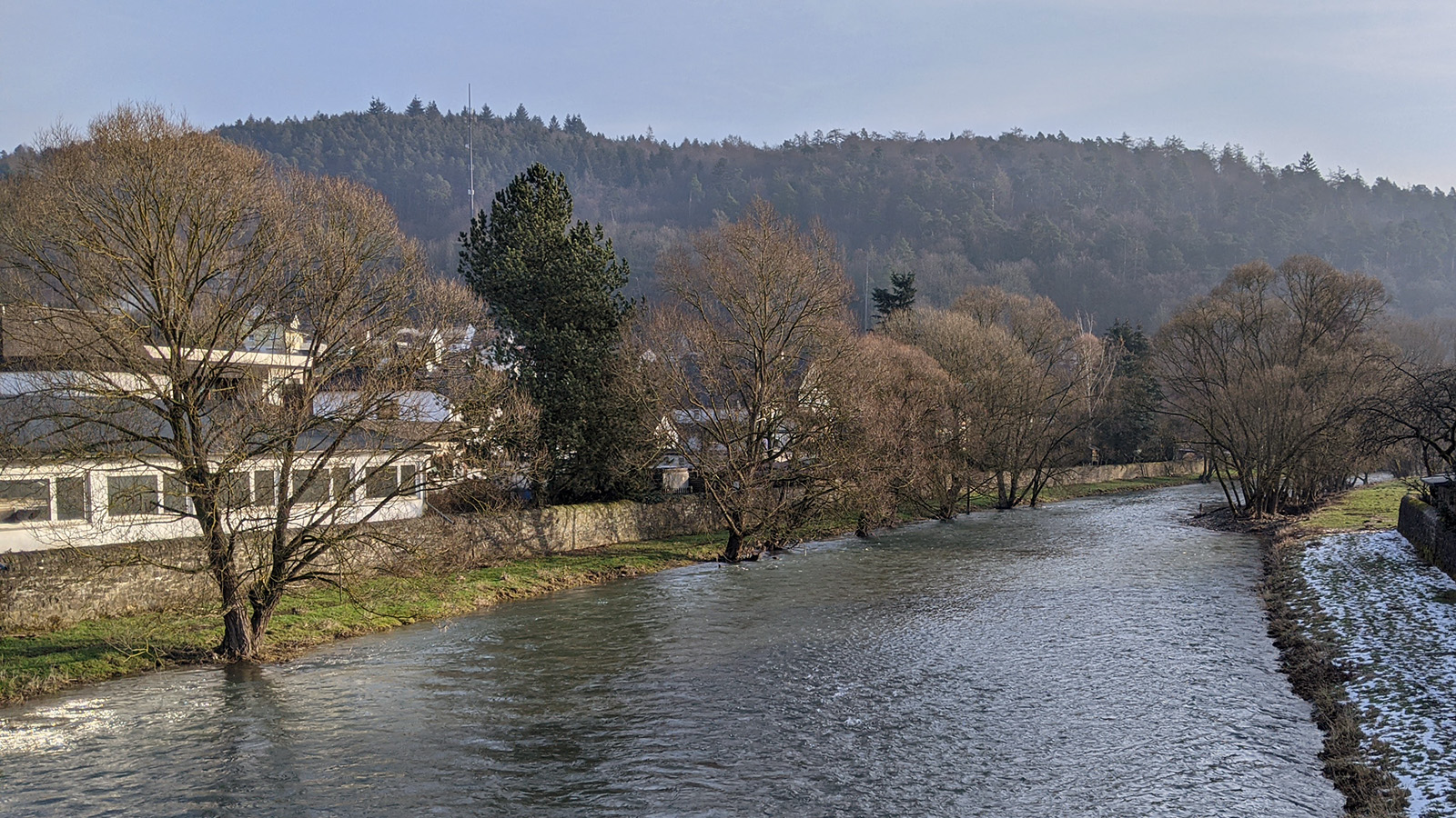
The Lahn river at Buchenau
I’m standing on a bridge across the river Lahn in unseasonably warm February sunshine. Ahead of me are the next two sections of the Lahn hiking trail (Lahnwanderweg), about 30km through the river valley and the hills around it. Normally that is not a big deal for me, but today is different, as so many things currently are.
14 days ago I suddenly lost my sense of smell, which turned the slight cold symptoms I had into something much more menacing. 11 days ago I received a call from my doctor that I was Covid-positive and that I was confined to my apartment for the next 10 days. 2 days ago the public health office called for a short interview and concluded that my quarantine could end as planned. Yesterday I did a short but brisk walk and felt fine.
But a lingering doubt remains. While I only had mild symptoms, they were spread out over the two weeks and my sense of smell has not fully returned. How will it affect my overall fitness? There are more than enough reports of lingering side effects.
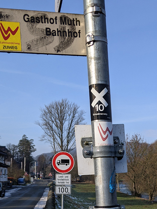
Trail signage is good.
So today is a test. There are several points on the walk where I can quit, and make my way back to my car here in Buchenau, but the plan is to make it all the way to Marburg and take the train from there. We’ll see how it goes.
The morning mist that obscured most of the hour-long drive to my starting point has largely cleared, but it is still far from the 14°C we are supposed to get today. I’m wrapped into several layers of clothing, but it is warm enough I don’t have to bother about gloves or a hat. The red LW sign of the trail points me out of the village and up into the hills above the Lahn, getting my blood pumping properly.
Past B&Bs and holiday apartments I slip into the woods and on the crest above I get my first beautiful view over Buchenau below.
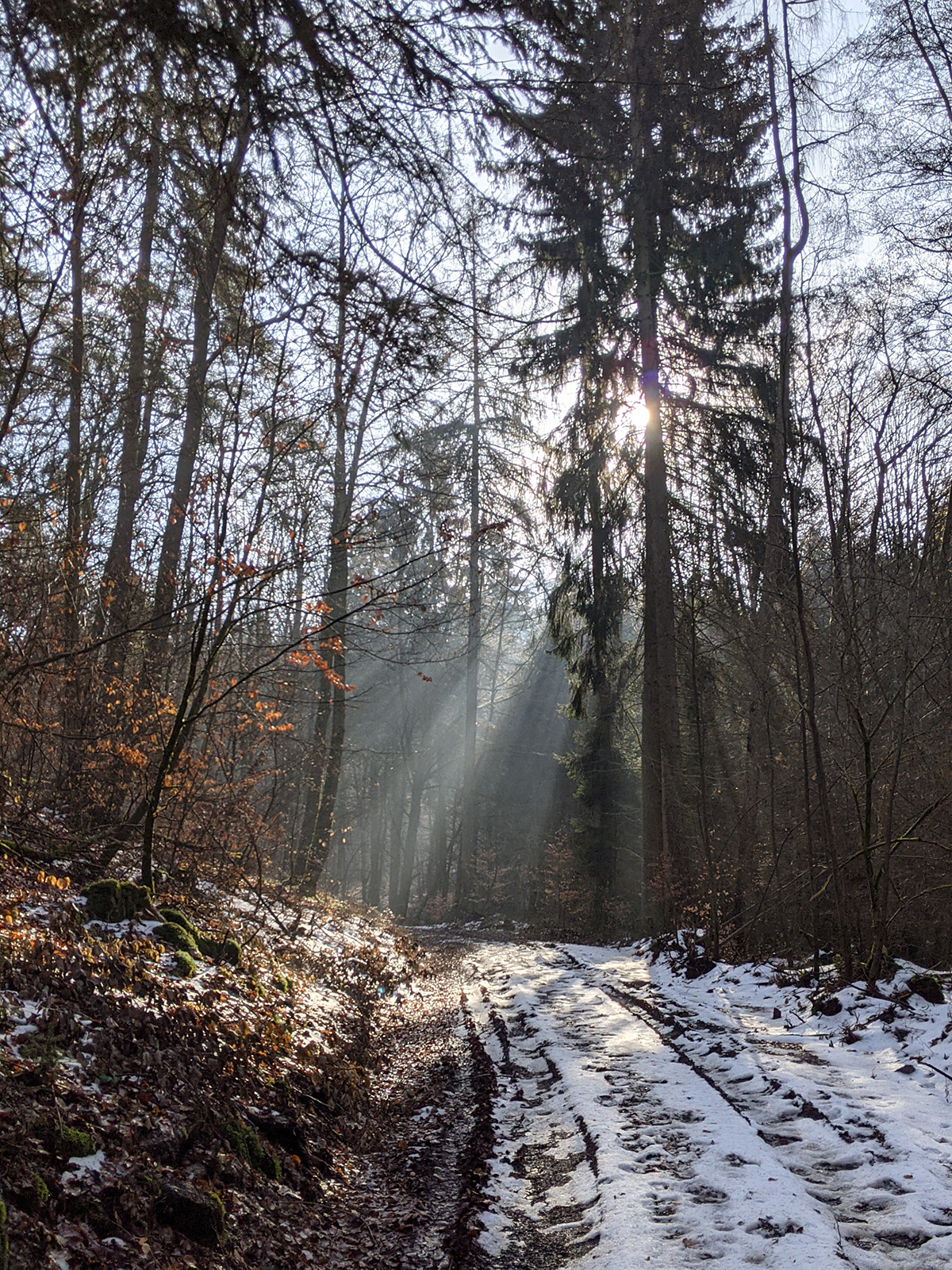
Parts of the path are still covered in snow and sometimes ice, but I make good time up unto the first hill of the day: Hohenfels. Here the remains of two small medieval castles are hidden among the trees. Only a few tumbling stones, rough embankments and some cellar holes are visible, but the site is well described through signs and explanations. I can easily imagine their strategic importance above the trade roads along the Lahn.
Being at such high spot means of course I have to go down again, sacrificing precious altitude I have gained already. I know I do have a bit more climbing ahead of me today, but I can be quite a miser if it comes to altitude.
The next hill is the Rimberg, the highest point of today’s walk, crowned by a tower with supposedly magnificent views. But before I can verify that, I have to get there. I do feel good, get a spring in my step, and prepare to fall into the rhythm of the walk … whoosh, suddenly my feet go flying on the wet and slippery grass. Miraculously I manage to catch myself with only one hand on the ground. Alright, take it slowly!
On the way from Hohenfels to the Rimberg.
In the shadow of the Roßberg and the Rimberg the ice and snow on the path gets heavier and I slow even further as I navigate the treacherous ground underfoot. The last incline towards the viewing tower atop the Rimberg is especially difficult and I’m wondering whether the full 30km will be feasible under these conditions.
But the wonderful views from the Rimberg distract me from these doubts and I have time to rest on the platform. Nobody else is around and the sky is as clear as it can be on such a warm winter’s day (meaning not very).
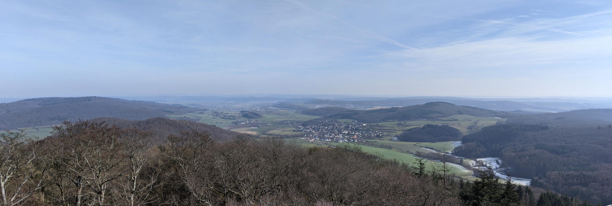
To the east I can clearly see Caldern, the next village on my itinerary, and the Lahn valley stretching away.
Caldern and the Lahn valley ahead
As I watch, two buzzards rise from the trees and begin circling, slowly making their way east into the valley. I take a deep breath, put away my flask of hot tea, shoulder my pack and follow them, just so much more awkwardly along the ground.
At first the trail is still difficult with ice and snow, but it gets better as I get lower into the valley and near Caldern. With the two buzzards still circling overhead I reach the small village with its prominent church tower welcoming me.
Here I can decide whether I want to continue or already catch a train back. What do my legs say? Well, they complain a bit about the awkward and slippery paths. What if it continues that way? But the next stretch is down here in the valley and the highest point for today is already behind me. So be quiet, you legs, onward we go.
I cross the Lahn behind Caldern and turn onto a tarmac bike path across the fields. On other days I might have complained about this stretch as “boring”, but today it is a welcome opportunity to straighten my wobbly legs after balancing across the ice.
I shift into “automatic” mode and a good hour later I reach Sterzhausen, the next opportunity for quitting for today. I realize I’m a bit tired now, after a little more than half the route, but not so much that I can’t imagine finishing it.
The choice is now between calling it a day and returning half-satisfied or going on and returning really knackered. Is that even a choice on a day hike? Of course I must go on!
Leaving Sterzhausen behind
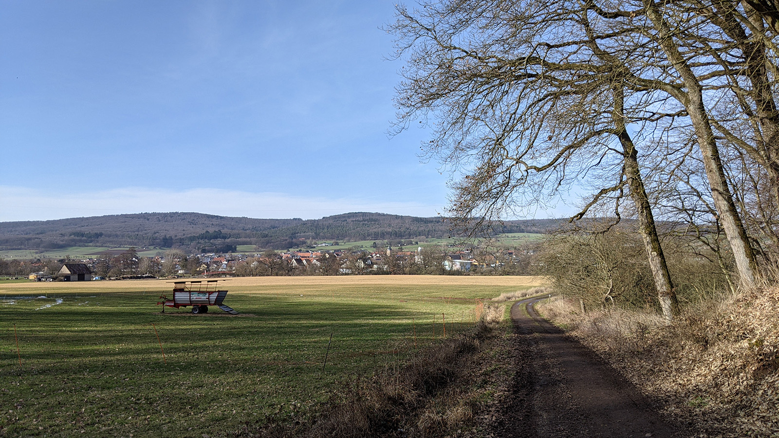
So I climb up again, to cut across the hills and avoid the large loop that the Lahn does around Cölbe. Here near Marbug and its suburbs a few more people are on the paths, dog-walkers, cyclists, joggers and afternoon walkers, but its still less than I expected on such a sunny Saturday. As I crest the hill I get to see Cölbe and touch on the outskirts of Wehrda, but then divert into the forest again to approach Marburg from the wooded hills in the west.
Cölbe (left) and Wehrda (right)
Elisabethkirche in Marburg
While the height of these last hills is less than the Rimberg early this morning, the ups and downs are quite steep and I’m now feeling my legs. I curse myself a little bit for my ambitious hiking plans, the the feeling vanishes as quickly as it came when I spot the twin spires of the St. Elisabeth Church in the evening light ahead, and the castle silhouetted against the sky on the ridge to my right.
I manage to slowly trundle into the bustling university town of Marburg (one of the oldest in Germany) with the setting sun, pretty much on time for the train back Buchenau.
Putting on the mask after a day of breathing the fresh air is a bit annoying, but nothing I can’t handle for the half hour journey on public transport. I gladly sink into the train seat, feeling tired but accomplished after 30km and seven and a half hours walking.
I’m very happy and feeling lucky that I was able to do this so shortly after my Covid-19 illness, but I’m also acutely aware that not everyone out there is as lucky. My hear goes out to all those more strongly affected. I hope you all recover as well as I was able and you soon get to do your favorite activities again!
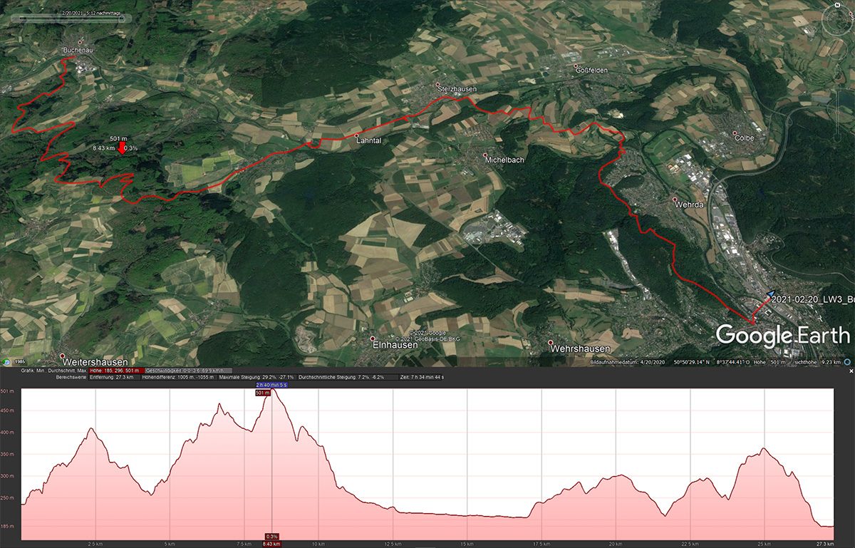
The route and height map from Buchenau to Marburg.
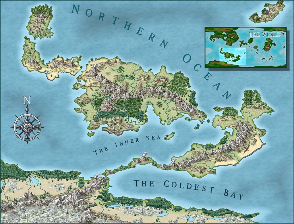
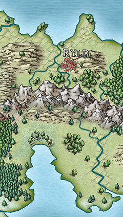
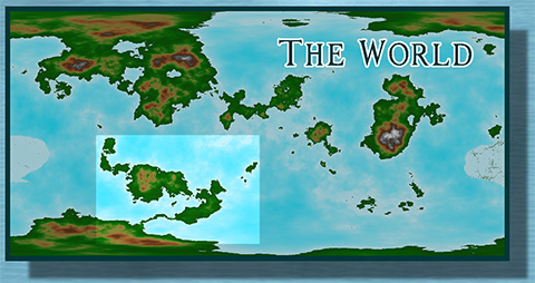
Here is another map commission I did recently: The southern continent of the world of Irth. It’s the setting for a private tabletop role-playing game and had only a few specifications. It was to be a continent on the southern hemisphere of a world, roughly similar in size to Australia, with a land-bridge to a polar continent.
I fired up Fractal Terrains 3, fiddled the settings and cycled through random worlds until I found something that roughly matched the requirements. I then went in and edited the world to add the land bridge and smooth out some wrinkles.
My customer was very happy with the initial layout and wanted to keep the whole world for future development. No problem with that and so I went ahead and took the desired continent out of FT3 into Campaign Cartographer 3+. I used the Mike Schley overland style to flesh it out somewhat, but the general brief was to only show the nation of Ryld and leave the rest relatively blank to be fleshed out by the owner. The ocean labels are basically just placeholders for future “real” names.
As a little extra I included the FT3 world in the map in the final version of the map to show the location of the continent in relation to the rest of the world.